Follow us
  • Facebook
  • Instagram
  • Linkedin
  • Twitter
  • YouTube
en
  • Italian
  • English
Log in
OGS  Home
Search

Search

Main Menu

  • The institute
    • About Us

      • Vision, mission and values
      • History
      • Governance
      • Organisation
      • Documents
      • Onorificenze
    • Section of Oceanography

      • Physical Oceanography Group
      • Chemical and Biological Oceanography
      • Dynamics of Ecosystems and Computational Oceanography
      • Oceanographic Research Infrastructures and Laboratories
    • Section of 
Geophysics

      • Geology and Marine Geophysics
      • Applied and Exploration Geophysics
      • Geophysics Research Infrastructures and Laboratories
    • Center for Seismological Research

      • Seismology and Geodesy
      • Engineering Sesimology
      • Seismological Research Infrastructures and Laboratories
    • Centre for Management of Maritime Infrastructures

      • Ship Management Group
      • Naval infrastructures
  • Activities
    • Missions

      • Seas and Ocean
      • Earth processes
      • Natural risk
      • Polar areas
      • Open science
    • Research

      • Projects
      • Attuazione misure PNRR
      • Bulletin of Geophysics and Oceanography
      • National Group of Solid Earth Geophysics (GNGTS)
      • Networks, associations and consortia
      • Publications
    • Innovation

      • Applied research and services
      • Patents and inventions
      • Technology clusters
      • Industrial partners
    • Science for Society

      • External relations
      • Blue Skills
      • High Performance Computing Laboratory (HPC-TRES)
      • The Laboratory on Quantitative Sustainability (TLQS)
      • Communication and dissemination
      • Citizen science
      • Game based learning
      • Scientific and environmental diplomacy
  • Infrastructures
    • Maritime infrastructures

      • Research vessel Laura Bassi
      • Other boats
    • European Infrastructures

      • European contribution to the Argo programme (Euro-Argo ERIC)
      • European Carbon Dioxide Capture and Storage Laboratory Infrastructure (ECCSEL ERIC)
      • Partnership for Advanced Computing in Europe (PRACE)
      • Other European Infrastructures
    • Oceanographic Infrastructures

      • Gulf of Trieste Platform
      • Capo Granitola Observatory
      • Glider Station
      • National Oceanographic Data Centre (NODC)
      • Oceanographic Calibration and Metrology Center (CTMO)
      • Technological development and support for acquisitions in the field (TEC)
      • Collection of Marine Microorganisms (CoSMi)
      • Testing tank
      • Marine Chemistry and Biology Laboratories (BioMarine Lab)
      • Arctic marine observing system
    • Geophysical Infrastructures

      • Geophysical exploration infrastructure (GeoExp)
      • Aerial remote sensing facility (AiRS)
      • Borehole geophysical test site (PiTOP)
      • Geophysical data distribution facilities
      • Processing data center
      • Terrestrial Geology Lab
      • Laboratory of Marine Geology
      • Seismic software Lab (SEISLAB)
      • Laboratorio multi-sensor core logger
    • Seismological and Geodetic Infrastructures

      • Northeast Italy monitoring system (SMINO)
      • Antarctic Seismographic Argentinean Italian Network (ASAIN)
      • Everest Seismological Station (EvK2-CNR)
      • Facilities for distribution of seismic & geodetic data
      • Seismological Calibration Centre
      • Field seismic networks and Mobile Labs
      • Seismic monitoring of industrial activities
      • Geodetic Monitoring of Landslide Phenomena
      • Sensor Development Laboratory
  • People
    • Contacts
    • HR Excellence in Research
    • Support for foreign researchers
    • Mobility
    • Associated personnel
  • Work with us
    • Gare e appalti
    • Concorsi
    • Altre opportunità
    • Professional qualification
    • Occupational health and safety
  • News
    • News
    • Press release
    • Cinque per mille
    • Press Office
    • Press resources
  • Contacts
    • Offices
    • Institutional contacts
    • Public Relations Office
    • Data protection officer
    • Responsabile per la Transizione al Digitale

Arctic marine observing system

Understanding oceanic processes even in remote areas of the planet is crucial to predicting environmental changes, knowing their causes and having the tools to remedy them.

Osservatorio Mare Artico
  1. Home/
  2. Oceanographic Infrastructures/
  3. Arctic marine observing system

The Arctic Ocean is becoming progressively warmer and saltier, with the consequence that sea ice is disappearing due to climate change and the process of Atlantification, i.e. the increasing influence of Atlantic water in the Arctic. The warm, salty Atlantic water is extending its flow northwards into the Arctic Ocean and mixing with cold Arctic water, reducing the ability of the polar region to produce dense water to sustain the global thermohaline circulation. 

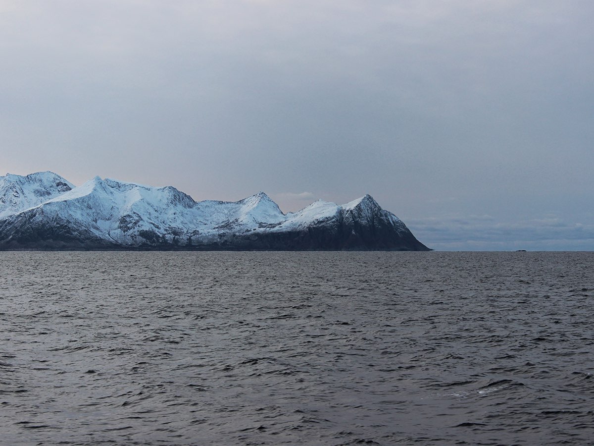
Ocean circulation in the Fram Strait is strongly influenced by both the interaction between Atlantic (northward-moving) and Arctic (southward-moving) waters as well as by the presence and winter formation of sea ice and atmospheric forcing. These processes contribute substantially to driving the thermohaline circulation on a global scale. In particular, in the easternmost part of the Fram Strait, relatively warm and salty Atlantic waters flow, bringing heat to the Arctic region and contributing to the Atlantification phenomenon. There is also considerable variability in the system generated by various local forcing (wind, atmospheric temperature, tides, exchange dynamics between the continental shelf and the open sea) that play an important role, especially in the shallowest layer of the ocean. However, it is not entirely clear what processes are responsible for the inter-annual and seasonal variability of the deep current flow in the open sea region west of the Svalbard archipelago (Spitsbergen) and what the implications are related to ongoing climate change and in particular to the progressive decrease of sea ice cover in the winter period.

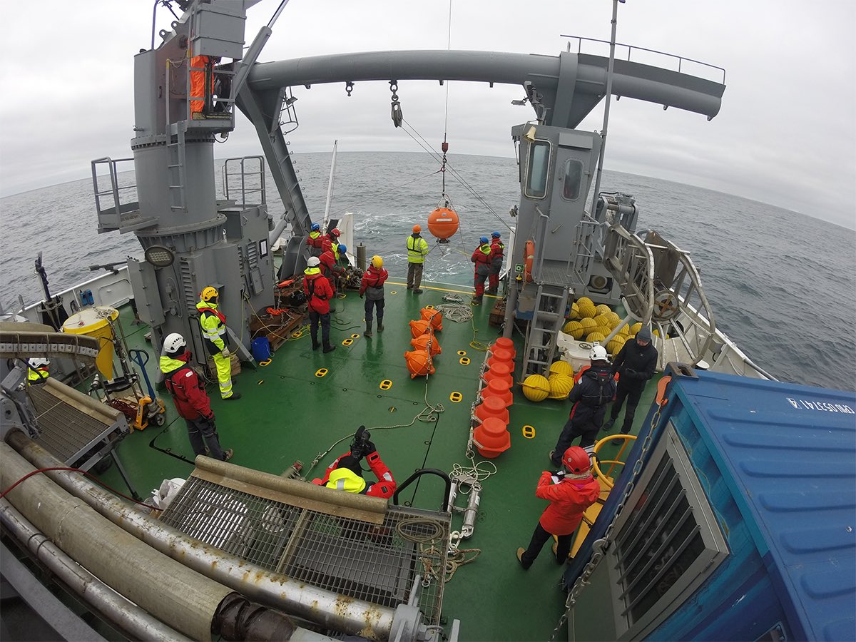
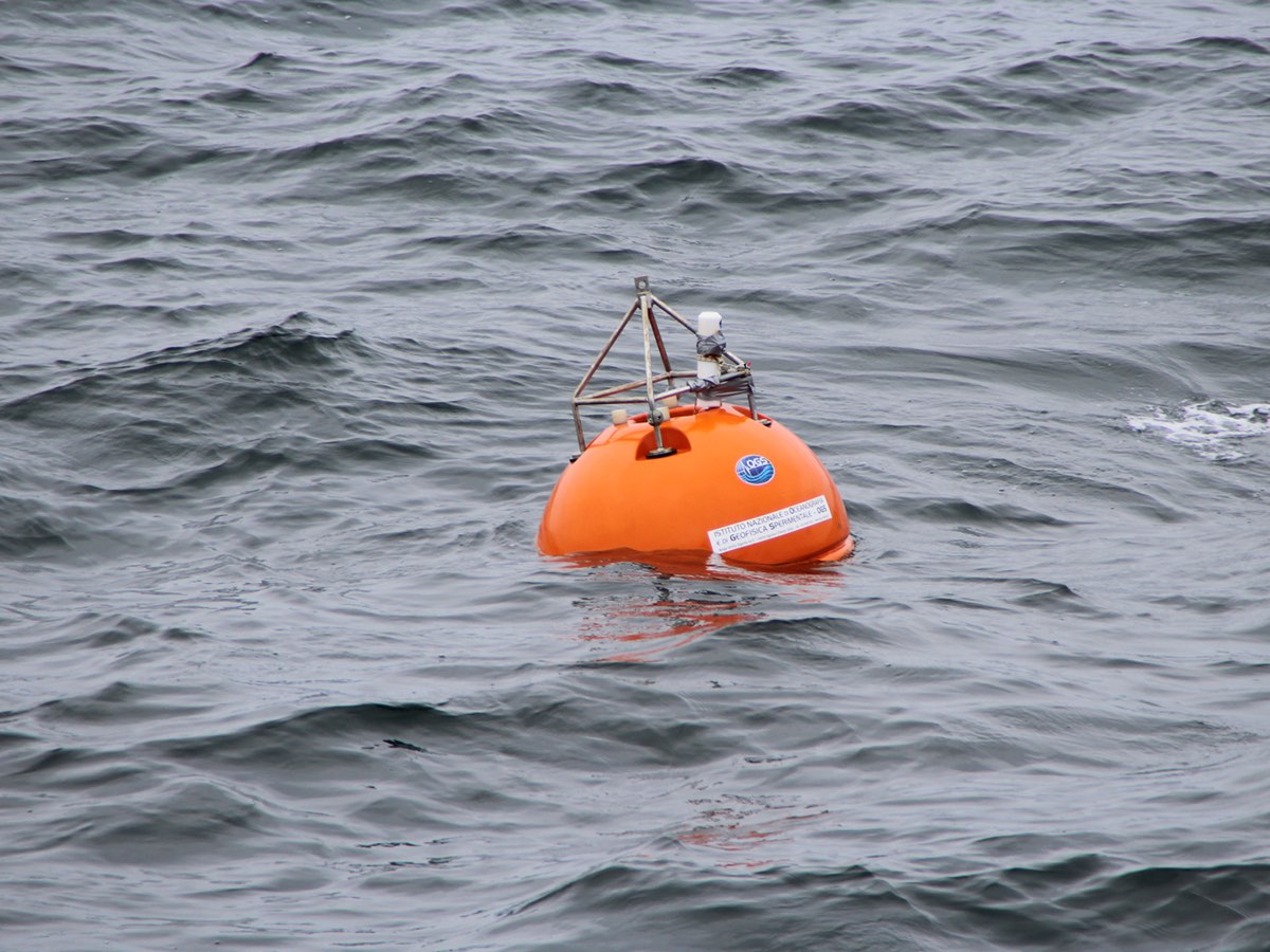
To understand these dynamics, a deep-water oceanographic anchorage called Mooring S1, located southwest of the Svalbard Islands (Lat. 76° 26.28'N; Lon. 13° 56.91'E) and anchored at about 1040 meters depth, was installed in June 2014 thanks to a joint effort between OGS and CNR. Equipped with sensors that measure the physical (temperature, salinity, direction and speed of currents) and biogeochemical (dissolved oxygen, turbidity, organic and inorganic matter) properties of seawater on an hourly basis, it records time series that are valuable for the study of climate change. The oceanographic sensors are anchored at different depths, between about 800 meters and 1040 meters.

In the same year, a twin anchorage named ID2 was positioned from 2014 to 2016 and from 2018 to 2019 about 140 kilometers further north than Mooring S1 with the aim of monitoring spatial differences in the properties and dynamics of water masses flowing along the eastern margin of the Fram Strait.   

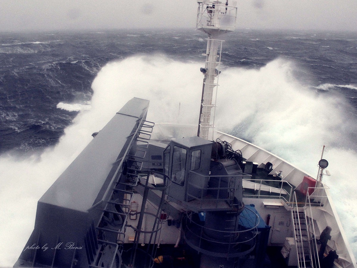
The oceanographic anchorages have been maintained on an annual basis through the deployment of several research vessels (Helmer Hansen, GO SARS, Polarstern, Alliance and Laura Bassi) and are supported by international collaborations and numerous projects/initiatives including: EU-Eurofleets (PREPARED, BURSTER projects), the Italian PNRA programme (DEFROST project). S1 and ID2 are also part of the observing system operated by the SIOS (Svalbard Integrated Arctic Earth Observing System) consortium. Since 2017, their maintenance has also been supported by the Italian Navy's HIGH NORTH programme, managed by the Istituto Idrografico della Marina (IIM) in collaboration with the Centro per la Ricerca e la Sperimentazione Marittima (CMRE-NATO).

Data from S1 and ID2 were used to contribute to the first two issues of "The State of Environmental Science in Svalbard - an annual report" published by SIOS in 2018 and 2019 (SOA project). Mooring data are downloaded during mooring maintenance, processed and quality checked and then stored in the OGS NODC data centre with connection to SeaDataNet and the Italian Arctic Data Center (IADC). 

At present, data on temperature, salinity, dissolved oxygen, turbidity and horizontal currents cover an interval from June 2014 to March 2021. Information on sedimentary processes and interactions with mesozooplankton, glaciers and coastal runoff is acquired by collecting, by means of automatic sedimentation traps, the particulate matter that precipitates along the water column. Since 2021, a sedimentation trap for studying microplastics has also been added. 

Future prospects include an implementation and uniformity of the observational systems with the establishment of a single Italian marine observational system managed by CNR-ISP and OGS that includes the marine systems present in the Ny-Alesund fjord (Kongsfjorden) and the open sea systems (S1 and ID2).

Organisation

OGS Contact
Manuel Bensi
Osservatorio Artico
Osservatorio Artico
Osservatorio Artico
Osservatorio Artico
Osservatorio Artico

Organisation

OGS Contact
Manuel Bensi

Footer menu

Institute

  • About Us
  • Organisation
  • Section of Oceanography
  • Section of 
Geophysics
  • Center for Seismological Research
  • Centre for Management of Maritime Infrastructures

Activity

  • Missions
  • Research
  • Innovation
  • Science for Society
  • Real time data

Infrastructures

  • Maritime infrastructures
  • European Infrastructures
  • Oceanographic Infrastructures
  • Geophysical Infrastructures
  • Seismological and Geodetic Infrastructures

Other

  • People
  • Job opportunity
  • Tenders (IT)
  • Human Resource Strategy (HRS4R)
  • News
  • Intranet
OGS  Home

Contacts

National Institute of Oceanography and Applied Geophysics - OGS
Borgo Grotta Gigante 42/C
34010 - Sgonico ( TS ) - Italy
Tel.+39 040 21401
Fax.+39 040 327307

C.F./P.IVA : 00055590327
Posta Elettronica Certificata: ogs@pec.it

Institute links

  • Albo pretorio
  • Amministrazione trasparente
  • Accesso civico
  • Dichiarazione di accessibilità
  • Statistiche web
Follow us
  • Facebook
  • Instagram
  • Linkedin
  • Twitter
  • YouTube

Small prints

Useful links section

  • Privacy and cookie policy
  • Legal
  • Social media policy