The Applied and Exploration Geophysics research group is a multidisciplinary team that performs geophysical research and national and international service activities both onshore, offshore and inshore, primarily in Italy and neighboring Mediterranean regions and contributes also to cryosphere research efforts both in Antarctica and Italy. Nested into this larger research group are smaller expert groups. These groups contribute towards underpinning these research activities, by being responsible for the management and development of geophysical infrastructures and instruments, data acquisition, processing and analyses (seismic, geoelectric, electromagnetic, gravity and magnetic data, and remote sensing), joint forward and inverse modelling, and open and fair data management and distribution, as well as environmental monitoring and citizen science.
Our main research fields include Environmental Geophysics, Exploration Geophysics, Water Resources, Petrophysics and Modelling. We have a long-standing experience in geo-resources (hydrocarbon, gas hydrates, geothermal and water resources), environmental studies (glaciology, hydrology, archeology) and basic research (theoretical models and synthetic modelling). A core strength is our ability to work through different stages of geophysical projects from planning to survey execution (in both onshore and offshore environs) to data processing and modelling.
Members of the team have developed algorithms and software (e.g CAT3D, ISTRICI and DRAGO) for tomography, imaging and modelling and also contribute to the SEISLAB software laboratory and PRACE computing infrastructure.
Environmental Geophysics
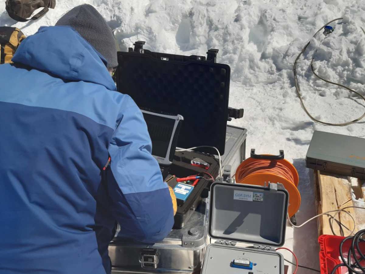
- Glacier geophysics
- Hydrology and hydrogeology
- Applied geology for engineering infrastructure (including tunnels, pipelines, ports and nuclear power plants)
- 3D subsurface characterization of landslides
- Environmental monitoring (air, land and sea) and Citizen science
Exploration Geophysics
- Seismic investigations for georesource applications (hydrocarbon, gas hydrate, geothermal)
- Seismic imaging of fault systems for geological mapping, seismicity and engineering hazards
- Seismic imaging for potential geological energy storage (e.g. carbon and hydrogen storage)
- Enhanced processing and analysis of seismic vintage data
- R&D of Seismic While Drilling (SWD) and VSP data analysis for drilling
Petrophysics and Modelling
- Hydrocarbon, gas hydrate and geothermal reservoir characterization
- Fluid modelling
- Development of elastic theories and modelling of viscoelastic waves
- High temperature rocks and associated supercritical fluids
- Tomographic inversion of seismic data, including seismic attenuation inversion
Water Resources
- Integrated models of subsurface aquifers from seismic, georadar, electromagnetic and gravity data
- 3D petrophysical properties of the subsurface and fluid analysis
- Airborne remote sensing of surface and subsurface water systems
Geophysical Data Acquisition
- Acquisition of onshore and nearshore seismic data (including multisensor wireless)
- Acquisition of offshore geophysical data (swath bathymetry, seismic, magnetic and gravity)
- Georadar data acquisition
- Geoelectric and electromagnetic data acquisition
- Airborne remote sensing and ground measurements
- Aerogeophysical data acquisition (aeromagnetic, airborne gravity)
- Borehole geophysics, Seismic While Drilling and VSP
Near Surface Geophysics
- Hydrogeology (river embankment studies)
- Slope stability
- Glaciology (ice sheets, glaciers and permafrost)
- Engineering (e.g. dams, pipelines and nuclear plants)
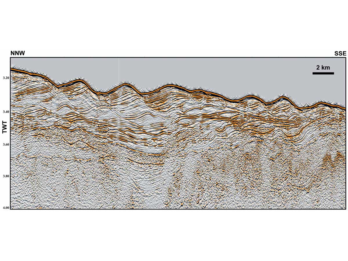
Crustal geophysics
- Seismic processing (2D, 3D and time lapse)
- Seismic imaging
- Gravity and magnetic data analyses
- Integrated geophysical data analysis
Modelling and petrophysics
- Rock physics theory and modelling
- Fluid flow modelling
- Numerical simulation of physical phenomena
- Synthetic data