Follow us
  • Facebook
  • Instagram
  • Linkedin
  • Twitter
  • YouTube
en
  • Italian
  • English
Log in
OGS  Home
Search

Search

Main Menu

  • The institute
    • About Us

      • Vision, mission and values
      • History
      • Governance
      • Organisation
      • Documents
      • Onorificenze
    • Section of Oceanography

      • Physical Oceanography Group
      • Chemical and Biological Oceanography
      • Dynamics of Ecosystems and Computational Oceanography
      • Oceanographic Research Infrastructures and Laboratories
    • Section of 
Geophysics

      • Geology and Marine Geophysics
      • Applied and Exploration Geophysics
      • Geophysics Research Infrastructures and Laboratories
    • Center for Seismological Research

      • Seismology and Geodesy
      • Engineering Sesimology
      • Seismological Research Infrastructures and Laboratories
    • Centre for Management of Maritime Infrastructures

      • Ship Management Group
      • Naval infrastructures
  • Activities
    • Missions

      • Seas and Ocean
      • Earth processes
      • Natural risk
      • Polar areas
      • Open science
    • Research

      • Projects
      • Attuazione misure PNRR
      • Bulletin of Geophysics and Oceanography
      • National Group of Solid Earth Geophysics (GNGTS)
      • Networks, associations and consortia
      • Publications
    • Innovation

      • Applied research and services
      • Patents and inventions
      • Technology clusters
      • Industrial partners
    • Science for Society

      • External relations
      • Blue Skills
      • High Performance Computing Laboratory (HPC-TRES)
      • The Laboratory on Quantitative Sustainability (TLQS)
      • Communication and dissemination
      • Citizen science
      • Game based learning
      • Scientific and environmental diplomacy
  • Infrastructures
    • Maritime infrastructures

      • Research vessel Laura Bassi
      • Other boats
    • European Infrastructures

      • European contribution to the Argo programme (Euro-Argo ERIC)
      • European Carbon Dioxide Capture and Storage Laboratory Infrastructure (ECCSEL ERIC)
      • Partnership for Advanced Computing in Europe (PRACE)
      • Other European Infrastructures
    • Oceanographic Infrastructures

      • Gulf of Trieste Platform
      • Capo Granitola Observatory
      • Glider Station
      • National Oceanographic Data Centre (NODC)
      • Oceanographic Calibration and Metrology Center (CTMO)
      • Technological development and support for acquisitions in the field (TEC)
      • Collection of Marine Microorganisms (CoSMi)
      • Testing tank
      • Marine Chemistry and Biology Laboratories (BioMarine Lab)
      • Arctic marine observing system
    • Geophysical Infrastructures

      • Geophysical exploration infrastructure (GeoExp)
      • Aerial remote sensing facility (AiRS)
      • Borehole geophysical test site (PiTOP)
      • Geophysical data distribution facilities
      • Processing data center
      • Terrestrial Geology Lab
      • Laboratory of Marine Geology
      • Seismic software Lab (SEISLAB)
      • Laboratorio multi-sensor core logger
    • Seismological and Geodetic Infrastructures

      • Northeast Italy monitoring system (SMINO)
      • Antarctic Seismographic Argentinean Italian Network (ASAIN)
      • Everest Seismological Station (EvK2-CNR)
      • Facilities for distribution of seismic & geodetic data
      • Seismological Calibration Centre
      • Field seismic networks and Mobile Labs
      • Seismic monitoring of industrial activities
      • Geodetic Monitoring of Landslide Phenomena
      • Sensor Development Laboratory
  • People
    • Contacts
    • HR Excellence in Research
    • Support for foreign researchers
    • Mobility
    • Associated personnel
  • Work with us
    • Gare e appalti
    • Concorsi
    • Altre opportunità
    • Professional qualification
    • Occupational health and safety
  • News
    • News
    • Press release
    • Cinque per mille
    • Press Office
    • Press resources
  • Contacts
    • Offices
    • Institutional contacts
    • Public Relations Office
    • Data protection officer
    • Responsabile per la Transizione al Digitale

Seismology and Geodesy

Characterization of seismicity (particularly in North-Eastern Italy), in relation to geodynamic processes and possible interactions with anthropogenic activities.

Sismologia Geodesia
  1. Home/
  2. Center for Seismological Research/
  3. Seismology and Geodesy

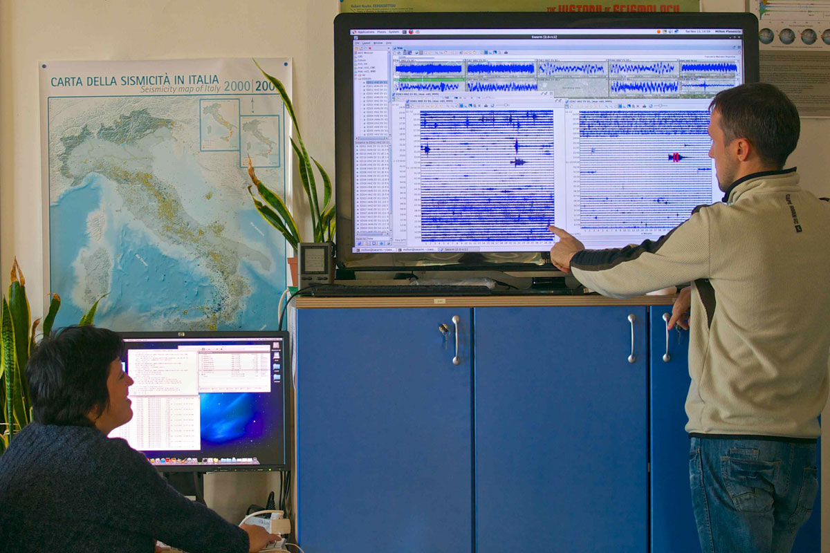
The research activity of the scientific group Seismology and Geodesy focuses on understanding seismogenesis (related both to natural causes and to processes induced by human activities) and to the evolution of seismicity in space and time. The group's activities touch on almost all phases of data processing, from acquisition to interpretation and numerical modelling. Key to this aim are studies of experimental and quantitative seismology with applications in the field of seismic monitoring and machine learning seismological applications to enrich seismic catalogues, by developing methods for the detection of microseismicity, repeated earthquakes and seismic transients.

Machine learning and statistical seismology methods are applied to seismic catalogues and particular attention is given to the analysis of energy partitioning during seismic sequences, the spatio-temporal distribution of recurrent strong earthquakes, the identification of clusters, the variation of the fractal dimension, and the estimation of the planes that best approximate the spatial distribution of background and intra-sequence seismicity. Seismicity clusters are also analysed in order to provide a prediction of the probability of strong shocks following the main event.

Part of the research activity is devoted to studying the seismic source and focal mechanisms, both with the classic method of fault plane solutions, based on the polarities of the first arrivals, and with the tensor moment inversion. For small earthquakes, the source parameters are also studied by spectral analysis.

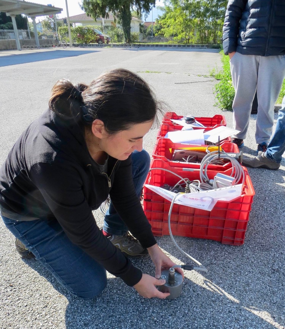
Within the group, an important monitoring activity of industrial sites is carried out, aimed at detecting possible seismicity induced or triggered by anthropogenic activities, complemented by the development of useful methods to distinguish induced seismicity from natural seismicity, and the study of earthquake generation following fluid diffusion or stress variations induced by non-tectonic causes. Monitoring of underground methane storage activities is currently underway at the Collalto (TV) and Cornegliano Laudense (LO) sites.

The arrival times recorded by the seismological networks are subject to tomographic inversions to estimate one- and three-dimensional velocity models and relocate seismic events, both at regional and local scales. Part of the activities is dedicated to constructing crustal models, useful to study, through appropriate modelling, the effects of variations in the field of stress and deformation on seismicity.

Complementary to seismological studies are studies in the geodetic field. The activities concern the processing of GNSS data, (including of course those of the SMINO network) and the analysis of GNSS time series aimed at distinguishing the contribution of hydrological phenomena from that of geodynamic processes in progress, in order to correctly define velocities, and at identifying transient signals. The joint analysis of results obtained from the analysis of GNSS data with those derived from INSAR images completes the group's expertise. Part of the research activity is aimed at identifying and quantifying any deformations induced by anthropogenic activities and displacements due to landslides.

Of special relevance is the development of scientific software, in particular that concerning machine learning methodologies and repopulation of catalogues, instrumental correction preparatory to source studies, to be made available to the scientific community.

P1120271
Installazione strumenti CRS

Footer menu

Institute

  • About Us
  • Organisation
  • Section of Oceanography
  • Section of 
Geophysics
  • Center for Seismological Research
  • Centre for Management of Maritime Infrastructures

Activity

  • Missions
  • Research
  • Innovation
  • Science for Society
  • Real time data

Infrastructures

  • Maritime infrastructures
  • European Infrastructures
  • Oceanographic Infrastructures
  • Geophysical Infrastructures
  • Seismological and Geodetic Infrastructures

Other

  • People
  • Job opportunity
  • Tenders (IT)
  • Human Resource Strategy (HRS4R)
  • News
  • Intranet
OGS  Home

Contacts

National Institute of Oceanography and Applied Geophysics - OGS
Borgo Grotta Gigante 42/C
34010 - Sgonico ( TS ) - Italy
Tel.+39 040 21401
Fax.+39 040 327307

C.F./P.IVA : 00055590327
Posta Elettronica Certificata: ogs@pec.it

Institute links

  • Albo pretorio
  • Amministrazione trasparente
  • Accesso civico
  • Dichiarazione di accessibilità
  • Statistiche web
Follow us
  • Facebook
  • Instagram
  • Linkedin
  • Twitter
  • YouTube

Small prints

Useful links section

  • Privacy and cookie policy
  • Legal
  • Social media policy