Follow us
  • Facebook
  • Instagram
  • Linkedin
  • Twitter
  • YouTube
en
  • Italian
  • English
Log in
OGS  Home
Search

Search

Main Menu

  • The institute
    • About Us

      • Vision, mission and values
      • History
      • Governance
      • Organisation
      • Documents
      • Onorificenze
    • Section of Oceanography

      • Physical Oceanography Group
      • Chemical and Biological Oceanography
      • Dynamics of Ecosystems and Computational Oceanography
      • Oceanographic Research Infrastructures and Laboratories
    • Section of 
Geophysics

      • Geology and Marine Geophysics
      • Applied and Exploration Geophysics
      • Geophysics Research Infrastructures and Laboratories
    • Center for Seismological Research

      • Seismology and Geodesy
      • Engineering Sesimology
      • Seismological Research Infrastructures and Laboratories
    • Centre for Management of Maritime Infrastructures

      • Ship Management Group
      • Naval infrastructures
  • Activities
    • Missions

      • Seas and Ocean
      • Earth processes
      • Natural risk
      • Polar areas
      • Open science
    • Research

      • Projects
      • Attuazione misure PNRR
      • Bulletin of Geophysics and Oceanography
      • National Group of Solid Earth Geophysics (GNGTS)
      • Networks, associations and consortia
      • Publications
    • Innovation

      • Applied research and services
      • Patents and inventions
      • Technology clusters
      • Industrial partners
    • Science for Society

      • External relations
      • Blue Skills
      • High Performance Computing Laboratory (HPC-TRES)
      • The Laboratory on Quantitative Sustainability (TLQS)
      • Communication and dissemination
      • Citizen science
      • Game based learning
      • Scientific and environmental diplomacy
  • Infrastructures
    • Maritime infrastructures

      • Research vessel Laura Bassi
      • Other boats
    • European Infrastructures

      • European contribution to the Argo programme (Euro-Argo ERIC)
      • European Carbon Dioxide Capture and Storage Laboratory Infrastructure (ECCSEL ERIC)
      • Partnership for Advanced Computing in Europe (PRACE)
      • Other European Infrastructures
    • Oceanographic Infrastructures

      • Gulf of Trieste Platform
      • Capo Granitola Observatory
      • Glider Station
      • National Oceanographic Data Centre (NODC)
      • Oceanographic Calibration and Metrology Center (CTMO)
      • Technological development and support for acquisitions in the field (TEC)
      • Collection of Marine Microorganisms (CoSMi)
      • Testing tank
      • Marine Chemistry and Biology Laboratories (BioMarine Lab)
      • Arctic marine observing system
    • Geophysical Infrastructures

      • Geophysical exploration infrastructure (GeoExp)
      • Aerial remote sensing facility (AiRS)
      • Borehole geophysical test site (PiTOP)
      • Geophysical data distribution facilities
      • Processing data center
      • Terrestrial Geology Lab
      • Laboratory of Marine Geology
      • Seismic software Lab (SEISLAB)
      • Laboratorio multi-sensor core logger
    • Seismological and Geodetic Infrastructures

      • Northeast Italy monitoring system (SMINO)
      • Antarctic Seismographic Argentinean Italian Network (ASAIN)
      • Everest Seismological Station (EvK2-CNR)
      • Facilities for distribution of seismic & geodetic data
      • Seismological Calibration Centre
      • Field seismic networks and Mobile Labs
      • Seismic monitoring of industrial activities
      • Geodetic Monitoring of Landslide Phenomena
      • Sensor Development Laboratory
  • People
    • Contacts
    • HR Excellence in Research
    • Support for foreign researchers
    • Mobility
    • Associated personnel
  • Work with us
    • Gare e appalti
    • Concorsi
    • Altre opportunità
    • Professional qualification
    • Occupational health and safety
  • News
    • News
    • Press release
    • Cinque per mille
    • Press Office
    • Press resources
  • Contacts
    • Offices
    • Institutional contacts
    • Public Relations Office
    • Data protection officer
    • Responsabile per la Transizione al Digitale

Geology and Marine Geophysics

Profilo sismico multicanale acquisito da OGS nel Mare Adriatico settentrionale
  1. Home/
  2. Section of 
Geophysics/
  3. Geology and Marine Geophysics

The Geology and Marine Geophysics research group carries out combined geophysical and geological research, both onshore and offshore, with a particular focus on marine environments from the coastline to deep oceanic basins, especially in the Mediterranean Sea and in the polar regions. 

The Geology and Marine Geophysics research group carries out combined geophysical and geological research, both onshore and offshore, with a particular focus on marine environments from the coastline to deep oceanic basins, especially in the Mediterranean Sea and in the polar regions. 

Our research addresses major societal and environmental issues, in line with the EU Marine Strategy and UN Ocean Decade policies. We focus on long-term processes and effects of climate change, evaluating marine hazards, and facilitating a sustainable use of subsurface and seafloor resources. We contribute to research into Carbon Capture Utilization & Storage, Hydrogen storage and geothermal systems relevant to the EU Green Deal and NetZero emissions roadmap. 
We undertake long-term geological and geophysical mapping and monitoring activities, both onshore and offshore in Italy and along the adjacent continental margins to underpin research efforts focused on basin analysis, paleoclimate, natural resources and geohazards.    

We have a long-standing interest in polar geosciences, specifically in geological and geophysical studies of the continental shelf and continental margins of Antarctica for paleoclimate and paleo ice sheet research. We are currently extending our collaborative national and international research activities in Antarctica and the Arctic by leveraging our recently acquired polar vessel Laura Bassi. 

Marine Geology & Basin Research

  • Geological mapping and monitoring (onshore and offshore)
  • Marine hazards including slope stability sediment and fluid seepage and flow
  • Coastal erosion due to canyon headwall dynamics
  • Faulting & Magmatism
  • Linkages between tectonic and geodynamic processes, seabed morphology and sedimentation
  • Paleoenvironmental reconstructions 

Polar Geosciences 

  • Paleoclimate and paleo ice sheet dynamics based on geophysical and geological data along polar continental margins
  • Numerical simulations of global and regional past climate change (Last deglaciation, Pliocene, Miocene, Oligocene)
  • Numerical simulations of past Northern Hemisphere and Antarctic ice sheet evolution, thresholds and past sea level changes
  • Mapping the subglacial lithosphere and linking Solid Earth and Cryosphere

Geoenergy and Environment 

  • Site selection and monitoring for potential CO2 and H2 geological storage systems  
  • Geomodelling of gas storage systems
  • Reservoir outcrop analogs
  • Impact of bottom-current controlled sedimentation in reservoirs 

Basin analysis (onshore-offshore)

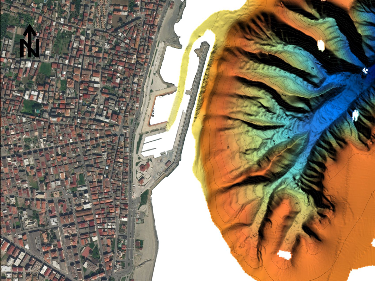
  • Swath bathymetry and seabed mapping
  • Seismic methods and Interpretation 
  • Geological field surveys
  • Structural geology
  • Sedimentology and stratigraphy
  • Subsidence analysis
  • Subsurface fluid flow 

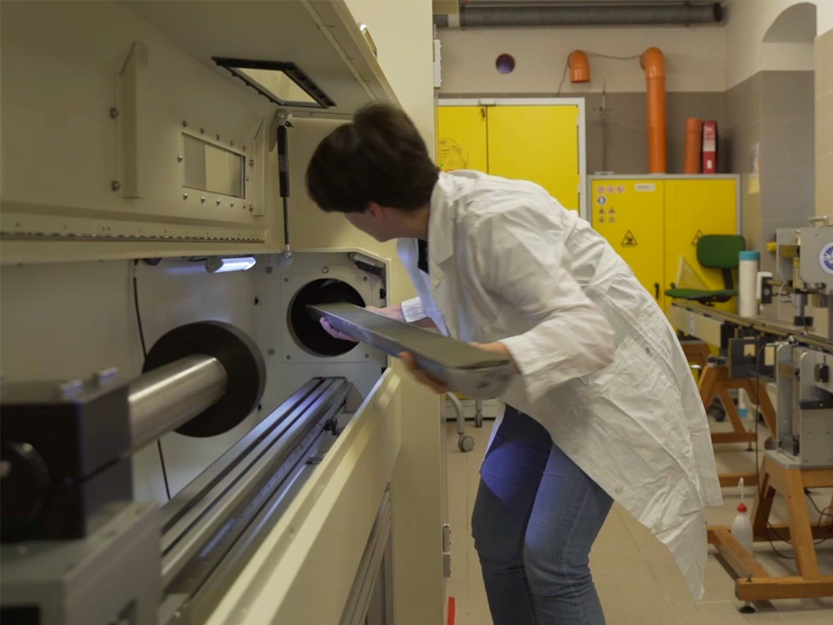
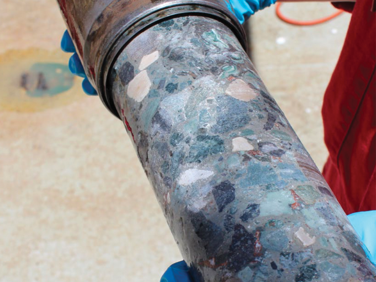
Scientific Drilling and Ground Truthing (IODP, MeBo, gravity/piston coring)

  • Litho-stratigraphy
  • Core- downhole logging analysis
  • Seismic-log calibration

Numerical modelling

  • Ice sheet dynamics
  • Glacio-isostatic adjustment
  • Climate dynamics (coupled or stand-alone ice sheet, ocean and atmosphere)
  • Backstripping of sedimentary sequences

Gravity and magnetic methods

  • Analysis of gravity and magnetic anomalies for tectonic and geological studies
  • Potential field models combined with geophysical, petrophysical and geological information
  • Linking satellite gravity/magnetic data with airborne, ground and marine observations
Morfobatimetria del canyon sottomarino di Cirò Marina
Core logger lab
OGS Essac

Footer menu

Institute

  • About Us
  • Organisation
  • Section of Oceanography
  • Section of 
Geophysics
  • Center for Seismological Research
  • Centre for Management of Maritime Infrastructures

Activity

  • Missions
  • Research
  • Innovation
  • Science for Society
  • Real time data

Infrastructures

  • Maritime infrastructures
  • European Infrastructures
  • Oceanographic Infrastructures
  • Geophysical Infrastructures
  • Seismological and Geodetic Infrastructures

Other

  • People
  • Job opportunity
  • Tenders (IT)
  • Human Resource Strategy (HRS4R)
  • News
  • Intranet
OGS  Home

Contacts

National Institute of Oceanography and Applied Geophysics - OGS
Borgo Grotta Gigante 42/C
34010 - Sgonico ( TS ) - Italy
Tel.+39 040 21401
Fax.+39 040 327307

C.F./P.IVA : 00055590327
Posta Elettronica Certificata: ogs@pec.it

Institute links

  • Albo pretorio
  • Amministrazione trasparente
  • Accesso civico
  • Dichiarazione di accessibilità
  • Statistiche web
Follow us
  • Facebook
  • Instagram
  • Linkedin
  • Twitter
  • YouTube

Small prints

Useful links section

  • Privacy and cookie policy
  • Legal
  • Social media policy