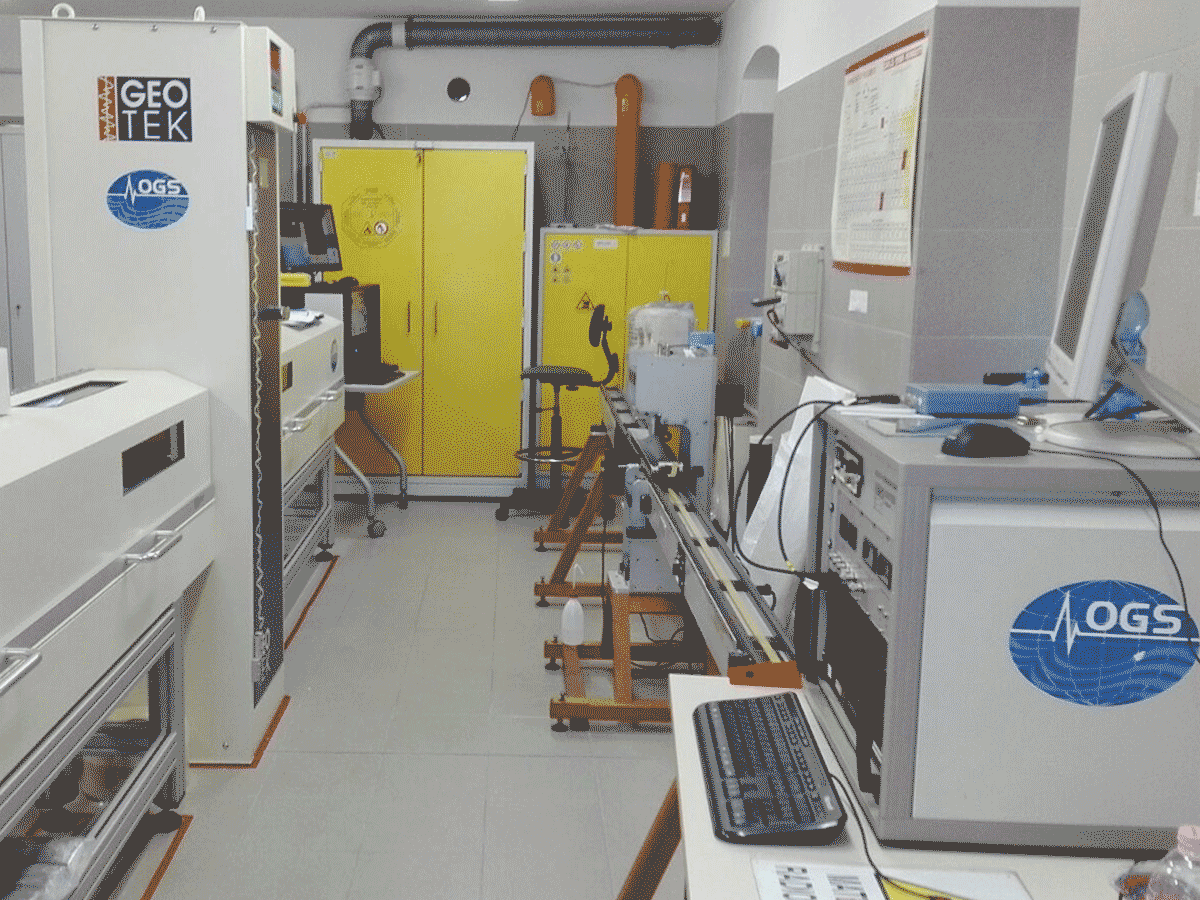
Follow us
  • Facebook
  • Instagram
  • Linkedin
  • Twitter
  • YouTube
en
  • Italian
  • English
Log in
OGS  Home
Search

Search

Main Menu

  • The institute
    • About Us

      • Vision, mission and values
      • History
      • Governance
      • Organisation
      • Documents
      • Onorificenze
    • Section of Oceanography

      • Physical Oceanography Group
      • Chemical and Biological Oceanography
      • Dynamics of Ecosystems and Computational Oceanography
      • Oceanographic Research Infrastructures and Laboratories
    • Section of 
Geophysics

      • Geology and Marine Geophysics
      • Applied and Exploration Geophysics
      • Geophysics Research Infrastructures and Laboratories
    • Center for Seismological Research

      • Seismology and Geodesy
      • Engineering Sesimology
      • Seismological Research Infrastructures and Laboratories
    • Centre for Management of Maritime Infrastructures

      • Ship Management Group
      • Naval infrastructures
  • Activities
    • Missions

      • Seas and Ocean
      • Earth processes
      • Natural risk
      • Polar areas
      • Open science
    • Research

      • Projects
      • Attuazione misure PNRR
      • Bulletin of Geophysics and Oceanography
      • National Group of Solid Earth Geophysics (GNGTS)
      • Networks, associations and consortia
      • Publications
    • Innovation

      • Applied research and services
      • Patents and inventions
      • Technology clusters
      • Industrial partners
    • Science for Society

      • External relations
      • Blue Skills
      • High Performance Computing Laboratory (HPC-TRES)
      • The Laboratory on Quantitative Sustainability (TLQS)
      • Communication and dissemination
      • Citizen science
      • Game based learning
      • Scientific and environmental diplomacy
  • Infrastructures
    • Maritime infrastructures

      • Research vessel Laura Bassi
      • Other boats
    • European Infrastructures

      • European contribution to the Argo programme (Euro-Argo ERIC)
      • European Carbon Dioxide Capture and Storage Laboratory Infrastructure (ECCSEL ERIC)
      • Partnership for Advanced Computing in Europe (PRACE)
      • Other European Infrastructures
    • Oceanographic Infrastructures

      • Gulf of Trieste Platform
      • Capo Granitola Observatory
      • Glider Station
      • National Oceanographic Data Centre (NODC)
      • Oceanographic Calibration and Metrology Center (CTMO)
      • Technological development and support for acquisitions in the field (TEC)
      • Collection of Marine Microorganisms (CoSMi)
      • Testing tank
      • Marine Chemistry and Biology Laboratories (BioMarine Lab)
      • Arctic marine observing system
    • Geophysical Infrastructures

      • Geophysical exploration infrastructure (GeoExp)
      • Aerial remote sensing facility (AiRS)
      • Borehole geophysical test site (PiTOP)
      • Geophysical data distribution facilities
      • Processing data center
      • Terrestrial Geology Lab
      • Laboratory of Marine Geology
      • Seismic software Lab (SEISLAB)
      • Laboratorio multi-sensor core logger
    • Seismological and Geodetic Infrastructures

      • Northeast Italy monitoring system (SMINO)
      • Antarctic Seismographic Argentinean Italian Network (ASAIN)
      • Everest Seismological Station (EvK2-CNR)
      • Facilities for distribution of seismic & geodetic data
      • Seismological Calibration Centre
      • Field seismic networks and Mobile Labs
      • Seismic monitoring of industrial activities
      • Geodetic Monitoring of Landslide Phenomena
      • Sensor Development Laboratory
  • People
    • Contacts
    • HR Excellence in Research
    • Support for foreign researchers
    • Mobility
    • Associated personnel
  • Work with us
    • Gare e appalti
    • Concorsi
    • Altre opportunità
    • Professional qualification
    • Occupational health and safety
  • News
    • News
    • Press release
    • Cinque per mille
    • Press Office
    • Press resources
  • Contacts
    • Offices
    • Institutional contacts
    • Public Relations Office
    • Data protection officer
    • Responsabile per la Transizione al Digitale

Multi-Sensor Core Logger Lab

Lab_multi-sensor_
  1. Home/
  2. Geophysical Infrastructures/
  3. Multi-Sensor Core Logger Lab

The Multi-Sensor Core Logger Lab focuses on non-destructive analysis on sediment cores and is equipped with:

  • Multi-Sensor Core Logger Geotek® (MSCL) which measures non-destructively the attenuation of gamma rays (gamma ray attenuation porosity evaluator, GRAPE), the velocity of compressional waves (P-wave velocities), and the amount of magnetically susceptible material present in the sediment. The MSCL enables a non-destructive mode of measurement on a fully automated system, providing high resolution (sampling interval up to 1 millimeter) whole-core and split-core logging data. It is also equipped with the GeoscanV system, allowing the acquisition of high-resolution photography of sediment cores, by using a digital camera with a dedicated lighting system.
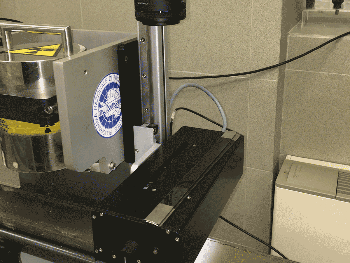
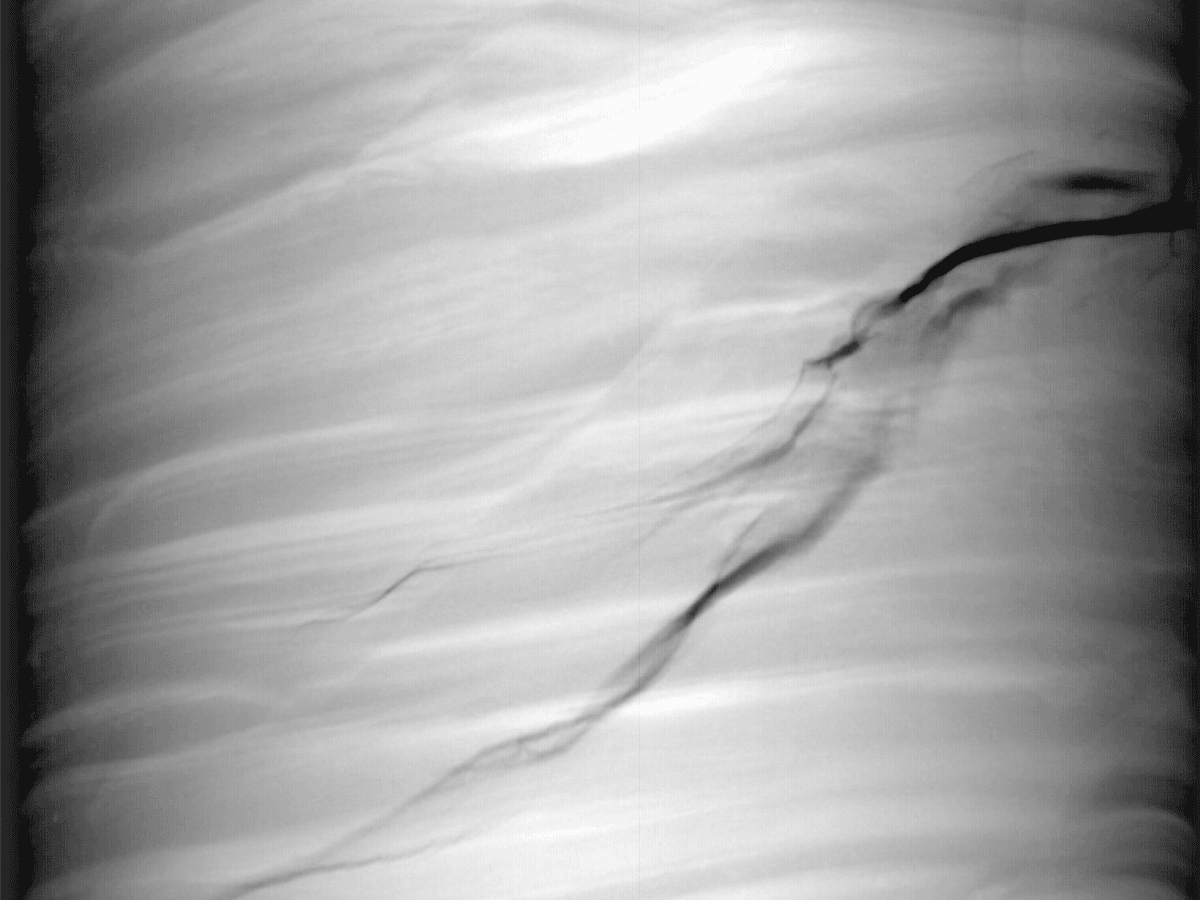
  • Standard X-RAY CT system which consists of a cabinet based on a lead-lined steel system designed to fully enclose an X-ray source, detector and core sample to be imaged. The X-ray CT instrument is specifically calibrated for different core samples, and collects images on split or whole core, through plastic or metal liners, and on cores up to 1.5 meters long and 5.25 inches in diameter. All X-ray data are acquired in accordance with ASTM D4452-14.

Since 1988, the laboratory, equipped with the Geotek® Multi Sensor Core Logger, has been hosted at OGS, where it has been used for many research and service’s activities. 

The Core Logging Lab is now part of a joint laboratories system in which OGS and University of Trieste share spaces and instrumentation for efficient use of research and teaching infrastructure, combining the laboratory facilities for sedimentological analyses of the two institutes. 

Organisation

OGS Contact
Andrea Caburlotto
CoreLoggingLab_Andrea Caburlotto
Geoscan_Andrea Caburlotto
X-RAY carotaggi_Andrea Caburlotto

Organisation

OGS Contact
Andrea Caburlotto

Footer menu

Institute

  • About Us
  • Organisation
  • Section of Oceanography
  • Section of 
Geophysics
  • Center for Seismological Research
  • Centre for Management of Maritime Infrastructures

Activity

  • Missions
  • Research
  • Innovation
  • Science for Society
  • Real time data

Infrastructures

  • Maritime infrastructures
  • European Infrastructures
  • Oceanographic Infrastructures
  • Geophysical Infrastructures
  • Seismological and Geodetic Infrastructures

Other

  • People
  • Job opportunity
  • Tenders (IT)
  • Human Resource Strategy (HRS4R)
  • News
  • Intranet
OGS  Home

Contacts

National Institute of Oceanography and Applied Geophysics - OGS
Borgo Grotta Gigante 42/C
34010 - Sgonico ( TS ) - Italy
Tel.+39 040 21401
Fax.+39 040 327307

C.F./P.IVA : 00055590327
Posta Elettronica Certificata: ogs@pec.it

Institute links

  • Albo pretorio
  • Amministrazione trasparente
  • Accesso civico
  • Dichiarazione di accessibilità
  • Statistiche web
Follow us
  • Facebook
  • Instagram
  • Linkedin
  • Twitter
  • YouTube

Small prints

Useful links section

  • Privacy and cookie policy
  • Legal
  • Social media policy