Follow us
  • Facebook
  • Instagram
  • Linkedin
  • Twitter
  • YouTube
en
  • Italian
  • English
Log in
OGS  Home
Search

Search

Main Menu

  • The institute
    • About Us

      • Vision, mission and values
      • History
      • Governance
      • Organisation
      • Documents
      • Onorificenze
    • Section of Oceanography

      • Physical Oceanography Group
      • Chemical and Biological Oceanography
      • Dynamics of Ecosystems and Computational Oceanography
      • Oceanographic Research Infrastructures and Laboratories
    • Section of 
Geophysics

      • Geology and Marine Geophysics
      • Applied and Exploration Geophysics
      • Geophysics Research Infrastructures and Laboratories
    • Center for Seismological Research

      • Seismology and Geodesy
      • Engineering Sesimology
      • Seismological Research Infrastructures and Laboratories
    • Centre for Management of Maritime Infrastructures

      • Ship Management Group
      • Naval infrastructures
  • Activities
    • Missions

      • Seas and Ocean
      • Earth processes
      • Natural risk
      • Polar areas
      • Open science
    • Research

      • Projects
      • Attuazione misure PNRR
      • Bulletin of Geophysics and Oceanography
      • National Group of Solid Earth Geophysics (GNGTS)
      • Networks, associations and consortia
      • Publications
    • Innovation

      • Applied research and services
      • Patents and inventions
      • Technology clusters
      • Industrial partners
    • Science for Society

      • External relations
      • Blue Skills
      • High Performance Computing Laboratory (HPC-TRES)
      • The Laboratory on Quantitative Sustainability (TLQS)
      • Communication and dissemination
      • Citizen science
      • Game based learning
      • Scientific and environmental diplomacy
  • Infrastructures
    • Maritime infrastructures

      • Research vessel Laura Bassi
      • Other boats
    • European Infrastructures

      • European contribution to the Argo programme (Euro-Argo ERIC)
      • European Carbon Dioxide Capture and Storage Laboratory Infrastructure (ECCSEL ERIC)
      • Partnership for Advanced Computing in Europe (PRACE)
      • Other European Infrastructures
    • Oceanographic Infrastructures

      • Gulf of Trieste Platform
      • Capo Granitola Observatory
      • Glider Station
      • National Oceanographic Data Centre (NODC)
      • Oceanographic Calibration and Metrology Center (CTMO)
      • Technological development and support for acquisitions in the field (TEC)
      • Collection of Marine Microorganisms (CoSMi)
      • Testing tank
      • Marine Chemistry and Biology Laboratories (BioMarine Lab)
      • Arctic marine observing system
    • Geophysical Infrastructures

      • Geophysical exploration infrastructure (GeoExp)
      • Aerial remote sensing facility (AiRS)
      • Borehole geophysical test site (PiTOP)
      • Geophysical data distribution facilities
      • Processing data center
      • Terrestrial Geology Lab
      • Laboratory of Marine Geology
      • Seismic software Lab (SEISLAB)
      • Laboratorio multi-sensor core logger
    • Seismological and Geodetic Infrastructures

      • Northeast Italy monitoring system (SMINO)
      • Antarctic Seismographic Argentinean Italian Network (ASAIN)
      • Everest Seismological Station (EvK2-CNR)
      • Facilities for distribution of seismic & geodetic data
      • Seismological Calibration Centre
      • Field seismic networks and Mobile Labs
      • Seismic monitoring of industrial activities
      • Geodetic Monitoring of Landslide Phenomena
      • Sensor Development Laboratory
  • People
    • Contacts
    • HR Excellence in Research
    • Support for foreign researchers
    • Mobility
    • Associated personnel
  • Work with us
    • Gare e appalti
    • Concorsi
    • Altre opportunità
    • Professional qualification
    • Occupational health and safety
  • News
    • News
    • Press release
    • Cinque per mille
    • Press Office
    • Press resources
  • Contacts
    • Offices
    • Institutional contacts
    • Public Relations Office
    • Data protection officer
    • Responsabile per la Transizione al Digitale

Geodetic Monitoring of Landslide Phenomena

frana
  1. Home/
  2. Seismological and Geodetic Infrastructures/
  3. Geodetic Monitoring of Landslide Phenomena

The Laboratory manages geodetic monitoring systems through GNSS technology of landslides.

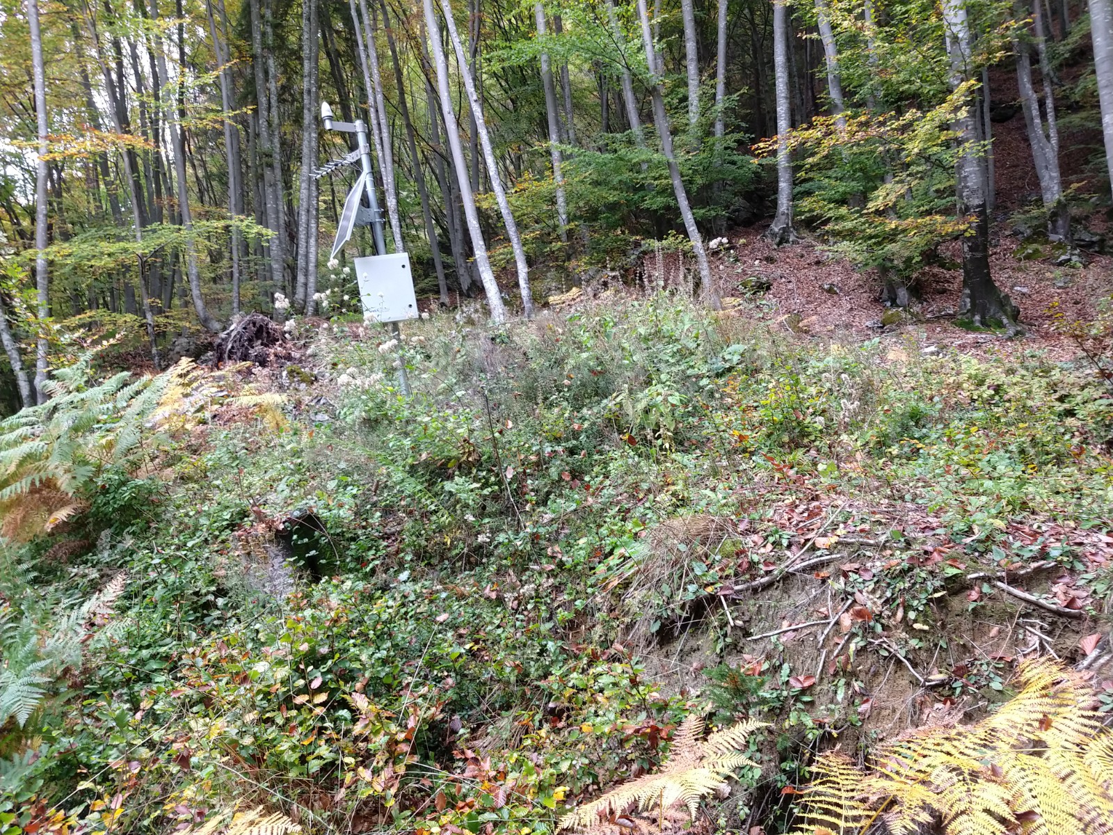
Since 2014, the Center for Seismological Research (CRS) of OGS has been involved in the setting up and implementation of a network of permanent GNSS stations for the characterization and monitoring of landslides upstream from the village of Cazzaso in the municipality of Tolmezzo (UD). To date, 14 stations are active. The monitoring system can estimate the movements, with a one-hour delay, and to ensure a timely notification to the local administration, which can manage the access routes and the possible evacuation of a residential area.

The monitoring activity is supported with funds from the municipality of Tolmezzo regulated by various agreements covering the period from the beginning of 2015 to the end of 2026:

https://www.ogs.it/it/progetti/cazzaso-monitoraggio

The work has been published in some scientific journals as per the links below:

  • Lavinia Tunini, David Zuliani, Federico Di Traglia, Lorenzo Borselli, Claudio De Luca, Teresa Nolesini, Francesco Casu (2024), Monitoring and modelling moraine landslides: an example from Cazzaso village (Carnic Alps, Italy), Bulletin of Geophysics and Oceanography; published online 12 July 2024, DOI 10.4430/bgo00459;
  • Zuliani, D.; Tunini, L.; Di Traglia, F.; Chersich, M.; Curone, D. Cost-Effective, Single-Frequency GPS Network as a Tool for Landslide Monitoring. Sensors 2022, 22, 3526. https://doi.org/10.3390/s22093526;


Thanks to the work carried out, OGS was recognized with the “Conoscere per prevenzione 2016” award for the project “The Esri Italia GNSS monitoring system SENDAS: the case history of the Tolmezzo (UD) landslide”. Award assigned by the Scientific Committee of the Esri Italia 2016 Conference on 20 April 2016 at the Leptis Magna Hall of the Ergife Palace Hotel in Rome, https://www.ogs.it/it/notizie/27-aprile-esri-italia-premia-logs


 also monitored, on behalf of the FVG Civil Protection, the left bank of the Livenza River near the town of Brugnera (PN) by means of a network of permanent GNSS stations. The activity was summarized in the works indicated below:

  • Zuliani, D.; Tunini, L.; Severin, M.; Bertoni, M.; Ponton, C.; Parolai, S. LZER0: A Cost-Effective Multi-Purpose GNSS Platform. Sensors 2022,22,8314.  https:// doi.org/10.3390/s22218314;
  • David Zuliani (2022). Monitoraggio GNSS delle frane. Soluzioni cost-effective e lo strumento in tempo reale LZERO, WORKSHOP “Interscambio di esperienze, presentazione di tecnologie e metodologie nella gestione delle emergenze”, Il workshop è stato organizzato da WORKSHOP organizzato da Italian Trade Agency (ITA), Agenzia per la promozione all'estero e l'internazionalizzazione delle imprese italiane, Auditorium - Centro Nacional de Prevención de Desastres (CENAPRED), Città del Messico, 6-8 luglio 2022;
  • D. Zuliani, P. Fabris, M. Bertoni, E. Del Negro, M. Severin (2019). MONITORAGGIO FRANE E GNSS COST-EFFECTIVE. Presentazione su invito. Convegno tra geologia e geofisica 2019 XVI Workshop di Geofisica. Sala conferenze “Fortunato Zeni” - Fondazione Museo Civico Rovereto Borgo S. Caterina 41, Rovereto – TN, giovedì 5 e venerdì 6 dicembre 2019, DOI: 10.13140/RG.2.2.10196.63361;

Organisation

OGS Contact
David Zuliani
Frana

Organisation

OGS Contact
David Zuliani

Footer menu

Institute

  • About Us
  • Organisation
  • Section of Oceanography
  • Section of 
Geophysics
  • Center for Seismological Research
  • Centre for Management of Maritime Infrastructures

Activity

  • Missions
  • Research
  • Innovation
  • Science for Society
  • Real time data

Infrastructures

  • Maritime infrastructures
  • European Infrastructures
  • Oceanographic Infrastructures
  • Geophysical Infrastructures
  • Seismological and Geodetic Infrastructures

Other

  • People
  • Job opportunity
  • Tenders (IT)
  • Human Resource Strategy (HRS4R)
  • News
  • Intranet
OGS  Home

Contacts

National Institute of Oceanography and Applied Geophysics - OGS
Borgo Grotta Gigante 42/C
34010 - Sgonico ( TS ) - Italy
Tel.+39 040 21401
Fax.+39 040 327307

C.F./P.IVA : 00055590327
Posta Elettronica Certificata: ogs@pec.it

Institute links

  • Albo pretorio
  • Amministrazione trasparente
  • Accesso civico
  • Dichiarazione di accessibilità
  • Statistiche web
Follow us
  • Facebook
  • Instagram
  • Linkedin
  • Twitter
  • YouTube

Small prints

Useful links section

  • Privacy and cookie policy
  • Legal
  • Social media policy