Follow us
  • Facebook
  • Instagram
  • Linkedin
  • Twitter
  • YouTube
en
  • Italian
  • Inglese
Log in
OGS  Home
Search

Search

Main Menu

  • The institute
    • About Us

      • Vision, mission and values
      • History
      • Governance
      • Organisation
      • Documents
      • Onorificenze
    • Section of Oceanography

      • Physical Oceanography Group
      • Chemical and Biological Oceanography
      • Dynamics of Ecosystems and Computational Oceanography
      • Oceanographic Research Infrastructures and Laboratories
    • Section of 
Geophysics

      • Geology and Marine Geophysics
      • Applied and Exploration Geophysics
      • Geophysics Research Infrastructures and Laboratories
    • Center for Seismological Research

      • Seismology and Geodesy
      • Engineering Sesimology
      • Seismological Research Infrastructures and Laboratories
    • Centre for Management of Maritime Infrastructures

      • Ship Management Group
      • Naval infrastructures
  • Activities
    • Missions

      • Seas and Ocean
      • Earth processes
      • Natural risk
      • Polar areas
      • Open science
    • Research

      • Projects
      • Attuazione misure PNRR
      • Bulletin of Geophysics and Oceanography
      • National Group of Solid Earth Geophysics (GNGTS)
      • Networks, associations and consortia
      • Publications
    • Innovation

      • Applied research and services
      • Patents and inventions
      • Technology clusters
      • Industrial partners
    • Science for Society

      • External relations
      • Blue Skills
      • High Performance Computing Laboratory (HPC-TRES)
      • The Laboratory on Quantitative Sustainability (TLQS)
      • Communication and dissemination
      • Citizen science
      • Game based learning
      • Scientific and environmental diplomacy
  • Infrastructures
    • Mobile Observation Systems

      • Research vessel Laura Bassi
      • European contribution to the Argo programme - Euro-Argo ERIC
      • Glider station
      • Geophysical exploration facility - GeoExp
      • Aerial remote sensing facility - AiRS
      • Field seismic networks and Mobile Lab
      • Autonomous underwater systems
      • Minor research vessels
    • Permanent observatories & monitoring networks

      • Terrestrial monitoring system of NE Italy - SMINO
      • Gulf of Trieste marine observatory
      • Southern Adriatic marine observatory
      • Arctic marine observatory
      • Sicily Channel marine observatory
      • Antarctic seismographic network - ASAIN
      • Everest seismological station - EvK2
      • Landslide monitory networks
      • Industrial activity monitoring networks
    • Laboratories, collections & calibration centres

      • European carbon dioxide capture and storage laboratory infrastructure - ECCSEL ERIC
      • Marine Chemistry and Biology Labs - BioMarine Labs
      • Oceanographic Calibration and Metrology Centre - CTMO
      • Oceanographic sensor development laboratory - TEC
      • Collection of marine microorganisms - CoSMi
      • Borehole geophysics test site - PITOP
      • Multi-sensor core logger lab - MSCL
      • Seismological Calibration Centre
      • Seismological sensor development laboratory
    • Data centres and scientific computing

      • Partnership for Advanced Computing in Europe - PRACE-Italy
      • National oceanographic data centre - NODC
      • Geophysical and bathymetric data distribution centre
      • Seismic software Lab - SEISLAB
      • Seismological and geodetic data distribution centre - SMINO-D
  • People
    • Contacts
    • HR Excellence in Research
    • Support for foreign researchers
    • Mobility
    • Associated personnel
  • Work with us
    • Gare e appalti
    • Concorsi
    • Altre opportunità
    • Professional qualification
    • Occupational health and safety
    • Qualità
  • News
    • News
    • Press release
    • Cinque per mille
    • Press Office
    • Press resources
  • Contacts
    • Offices
    • Institutional contacts
    • Public Relations Office
    • Data protection officer
    • Responsabile per la Transizione al Digitale

Geophysical and bathymetric data distribution centre

snap
  1. Home/
  2. Data centres and scientific computing/
  3. Geophysical and bathymetric data distribution centre

OGS holds a leading position in the field of open data, having developed many of the technologies for the management of and web access to geophysical data used in numerous international data-sharing initiatives.

The Geophysical and Bathymetric Data Distribution Centre manages the processing, integration, storage and dissemination of marine and terrestrial geophysical data.

  • Objectives: to process and integrate geophysical and bathymetric data; to ensure consistent georeferencing and secure archiving; and to disseminate data at both national and international level.
  • Instrumentation: processing systems, structured databases and metadata catalogues for the management of large volumes of data.
  • Data management: OGS stores, enhances and distributes datasets through dedicated portals, supporting research and international data sharing.

The Centre brings together the scientific and technological expertise required for the processing of seismic data, both in the field of crustal geophysical exploration (geodynamics, seismic stratigraphy, seismicity and the exploitation of geo-resources) and in that of high-resolution near-surface geophysical exploration (civil engineering, hydrogeology and geothermal energy). Standard and advanced processing techniques are employed and adapted to the type of data being handled (for example, modern or “vintage” data, acquired on land or at sea), with the aim of obtaining the best possible image of the subsurface.

Adopting a FAIR (Findable, Accessible, Interoperable, Reusable) approach and developing and using internationally recognized standards, OGS is in fact a reference point for data accessibility at an international level. These activities are stored and presented in two main web portals that OGS manages:

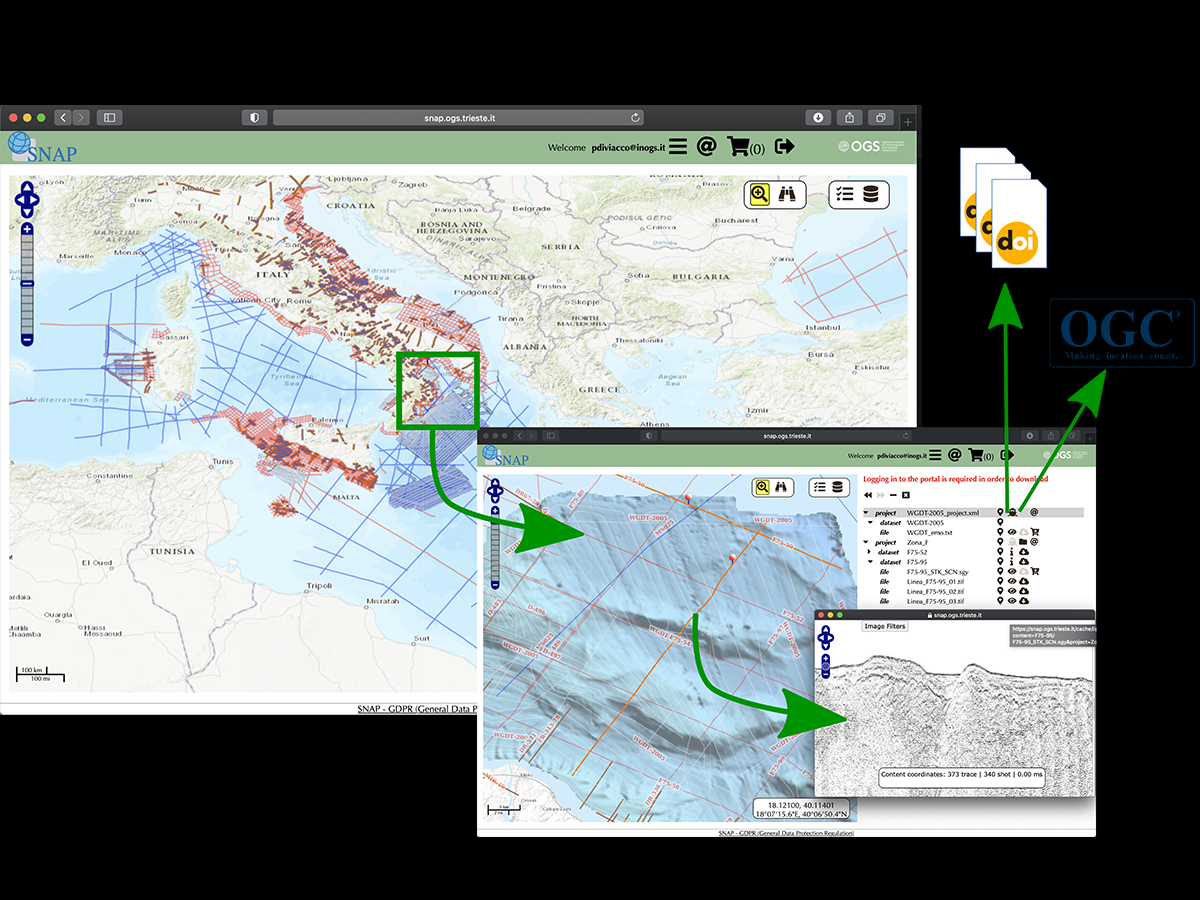
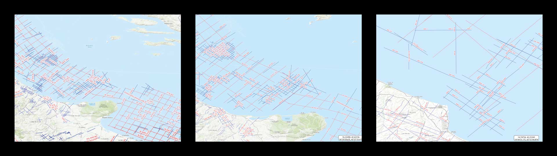
  • SNAP where over 100.000 kilometers of seismic lines in the Mediterranean and Black Sea area are made available a short time after acquisition, but also where it is possible to find vintage data that have been recovered from paper sections and that are extremely important because of the environmental limitations imposed on new acquisitions.
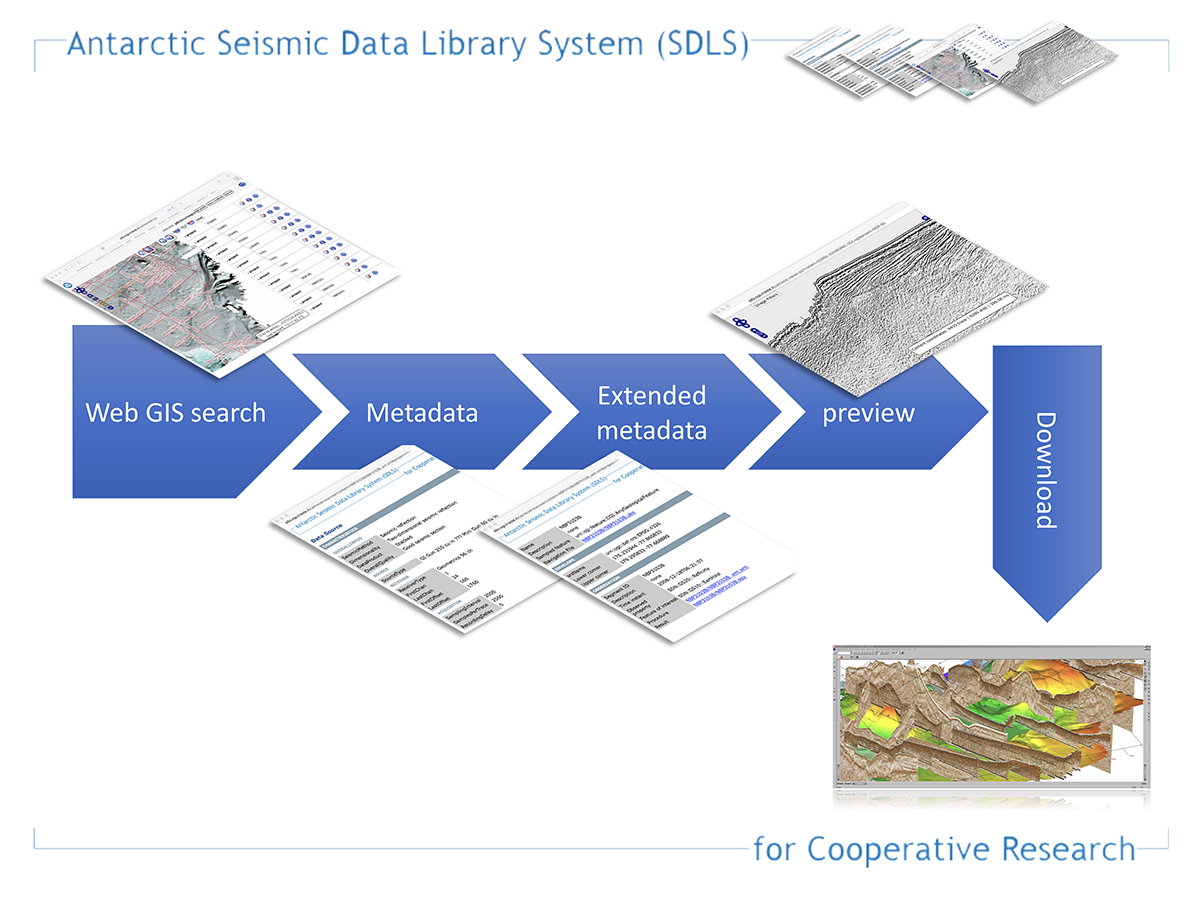
  • The Antarctic Seismic data Library System, a hub for all the seismic data acquired by all research institutions in Antarctica. This initiative and portal hosts more than 350.000 kilometers of seismic lines.

All the systems managed by OGS (geophysical data distribution infrastructure of the GEO section) are fully interoperable with major data sharing initiatives at National and International level (SeaDataNet, EMODnet, NADC and similar) and are compliant with principal data and metadata standards.

The Open Data approach allows researchers from the geophysical community to find and access data they are interested in, but through web semantic technologies it is possible to project data managed by OGS also towards other communities where they can be integrated in initially unforecastable multidisciplinary studies.

The Open Data approach and the possibility to use the developed systems in multiple contexts prompted OGS to develop a further research line that aims at developing technologies and paradigms designed for policymakers and society at large, both in the dissemination of the results of research and in their involvement in the activities of research themselves.

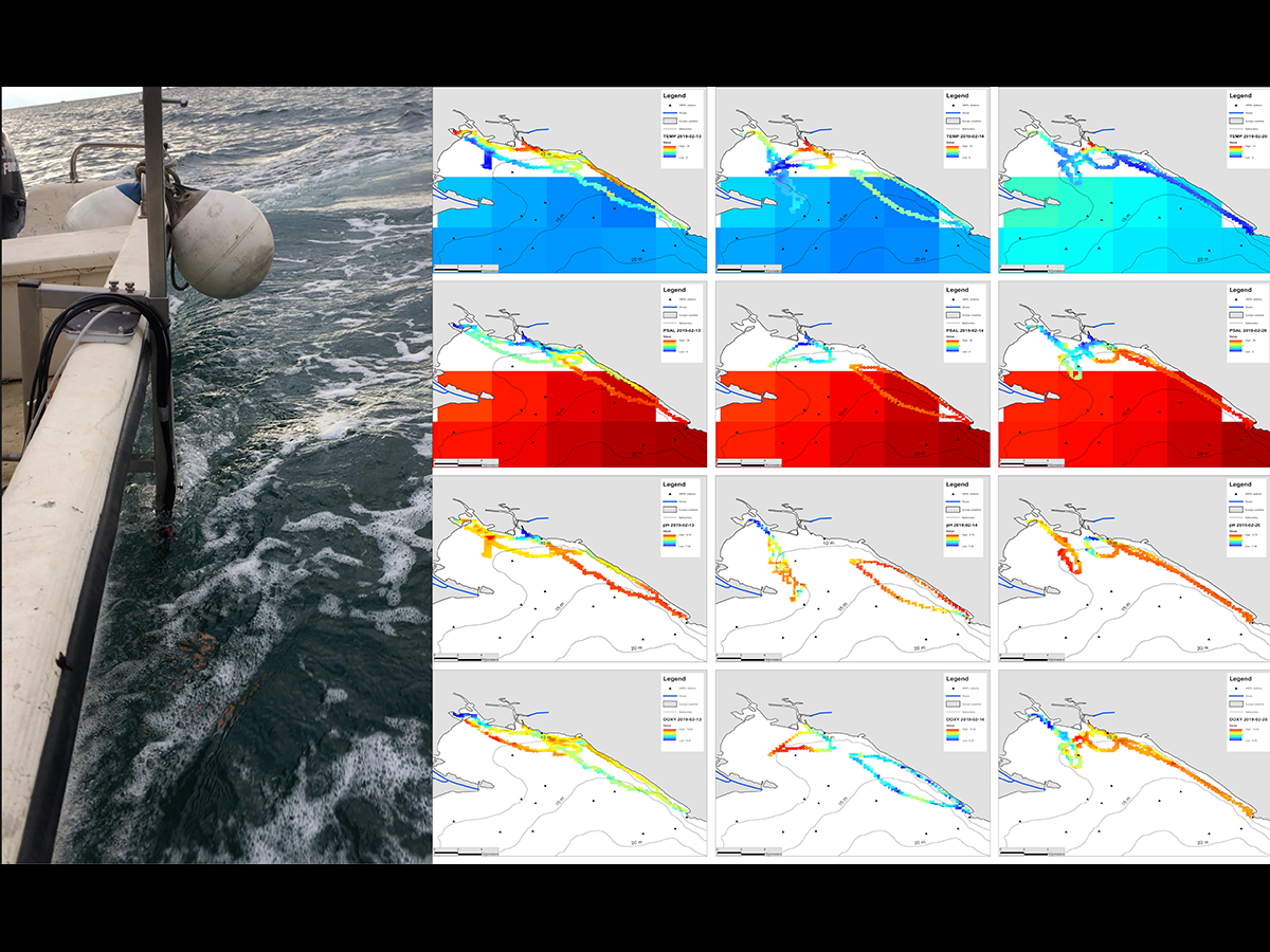
To this end, OGS has developed a citizen science infrastructure called GENA, which enables the acquisition, transmission, consolidation within a database, and visualisation through a web portal of real-time measurements of any kind (water quality, air quality, noise pollution and more). These measurements can be carried out independently by volunteers (citizen scientists) equipped with low-cost sensors connected to transmission systems, thereby considerably increasing the geographical and temporal coverage of measurements while significantly reducing acquisition costs.

The enormous quantity and heterogeneity of the data collected in this way require analysis techniques based on artificial intelligence to help analysts identify features of interest quickly and effectively. A specific line of research has therefore also been developed in this area.

Organisation
OGS Contact
Paolo Diviacco
Edy Forlin
Crowdsourcing
SDLS
SNAP

Organisation

OGS Contact
Paolo Diviacco
Edy Forlin

Footer menu

Institute

  • About Us
  • Organisation
  • Section of Oceanography
  • Section of 
Geophysics
  • Center for Seismological Research
  • Centre for Management of Maritime Infrastructures

Activity

  • Missions
  • Research
  • Innovation
  • Science for Society
  • Real time data

Infrastructures

  • Maritime infrastructures
  • European Infrastructures
  • Oceanographic Infrastructures
  • Geophysical Infrastructures
  • Seismological and Geodetic Infrastructures

Other

  • People
  • Job opportunity
  • Tenders (IT)
  • Human Resource Strategy (HRS4R)
  • News
  • Intranet
OGS  Home

Contacts

National Institute of Oceanography and Applied Geophysics - OGS
Borgo Grotta Gigante 42/C
34010 - Sgonico ( TS ) - Italy
Tel.+39 040 21401
Fax.+39 040 327307

C.F./P.IVA : 00055590327
Posta Elettronica Certificata: ogs@pec.it

Institute links

  • Albo pretorio
  • Amministrazione trasparente
  • Accesso civico
  • Dichiarazione di accessibilità
  • Segnalazione di accessibilità
  • Statistiche web
Follow us
  • Facebook
  • Instagram
  • Linkedin
  • Twitter
  • YouTube

Small prints

Useful links section

  • Privacy and cookie policy
  • Legal
  • Social media policy