Follow us
  • Facebook
  • Instagram
  • Linkedin
  • Twitter
  • YouTube
en
  • Italian
  • Inglese
Log in
OGS  Home
Search

Search

Main Menu

  • The institute
    • About Us

      • Vision, mission and values
      • History
      • Governance
      • Organisation
      • Documents
      • Onorificenze
    • Section of Oceanography

      • Physical Oceanography Group
      • Chemical and Biological Oceanography
      • Dynamics of Ecosystems and Computational Oceanography
      • Oceanographic Research Infrastructures and Laboratories
    • Section of 
Geophysics

      • Geology and Marine Geophysics
      • Applied and Exploration Geophysics
      • Geophysics Research Infrastructures and Laboratories
    • Center for Seismological Research

      • Seismology and Geodesy
      • Engineering Sesimology
      • Seismological Research Infrastructures and Laboratories
    • Centre for Management of Maritime Infrastructures

      • Ship Management Group
      • Naval infrastructures
  • Activities
    • Missions

      • Seas and Ocean
      • Earth processes
      • Natural risk
      • Polar areas
      • Open science
    • Research

      • Projects
      • Attuazione misure PNRR
      • Bulletin of Geophysics and Oceanography
      • National Group of Solid Earth Geophysics (GNGTS)
      • Networks, associations and consortia
      • Publications
    • Innovation

      • Applied research and services
      • Patents and inventions
      • Technology clusters
      • Industrial partners
    • Science for Society

      • External relations
      • Blue Skills
      • High Performance Computing Laboratory (HPC-TRES)
      • The Laboratory on Quantitative Sustainability (TLQS)
      • Communication and dissemination
      • Citizen science
      • Game based learning
      • Scientific and environmental diplomacy
  • Infrastructures
    • Mobile Observation Systems

      • Research vessel Laura Bassi
      • European contribution to the Argo programme - Euro-Argo ERIC
      • Glider station
      • Geophysical exploration facility - GeoExp
      • Aerial remote sensing facility - AiRS
      • Field seismic networks and Mobile Lab
      • Autonomous underwater systems
      • Minor research vessels
    • Permanent observatories & monitoring networks

      • Terrestrial monitoring system of NE Italy - SMINO
      • Gulf of Trieste marine observatory
      • Southern Adriatic marine observatory
      • Arctic marine observatory
      • Sicily Channel marine observatory
      • Antarctic seismographic network - ASAIN
      • Everest seismological station - EvK2
      • Landslide monitory networks
      • Industrial activity monitoring networks
    • Laboratories, collections & calibration centres

      • European carbon dioxide capture and storage laboratory infrastructure - ECCSEL ERIC
      • Marine Chemistry and Biology Labs - BioMarine Labs
      • Oceanographic Calibration and Metrology Centre - CTMO
      • Oceanographic sensor development laboratory - TEC
      • Collection of marine microorganisms - CoSMi
      • Borehole geophysics test site - PITOP
      • Multi-sensor core logger lab - MSCL
      • Seismological Calibration Centre
      • Seismological sensor development laboratory
    • Data centres and scientific computing

      • Partnership for Advanced Computing in Europe - PRACE-Italy
      • National oceanographic data centre - NODC
      • Geophysical and bathymetric data distribution centre
      • Seismic software Lab - SEISLAB
      • Seismological and geodetic data distribution centre - SMINO-D
  • People
    • Contacts
    • HR Excellence in Research
    • Support for foreign researchers
    • Mobility
    • Associated personnel
  • Work with us
    • Gare e appalti
    • Concorsi
    • Altre opportunità
    • Professional qualification
    • Occupational health and safety
    • Qualità
  • News
    • News
    • Press release
    • Cinque per mille
    • Press Office
    • Press resources
  • Contacts
    • Offices
    • Institutional contacts
    • Public Relations Office
    • Data protection officer
    • Responsabile per la Transizione al Digitale

Sicily Channel marine observatory

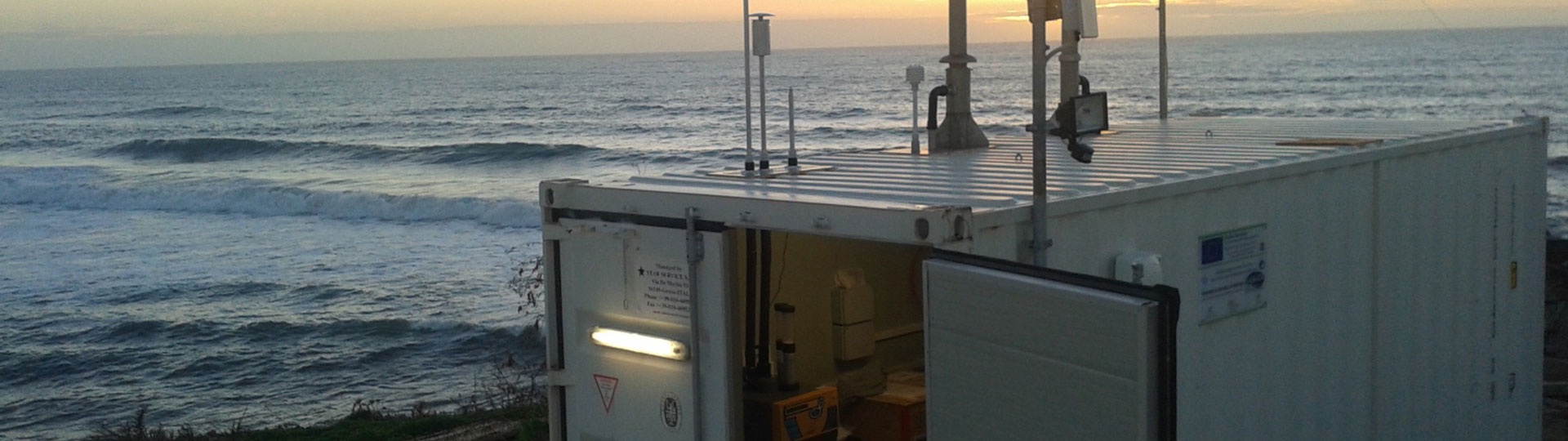
Capo Granitola Observatory (Mazara del Vallo - Sicily), an integrated system for the monitoring of the state of the sea.

Osservatorio radar a Capo Granitola
  1. Home/
  2. Permanent observatories & monitoring networks/
  3. Sicily Channel marine observatory

The Sicily Channel marine observatory is a system that integrates several observational platforms operating in the area, which ensure a continuous flow of oceanographic data for monitoring the state of the sea in scenarios of climate change. The acquired data will feed into the Decision Support System (DSS), which allows for emergency management in the Malta and Sicily Channel.

The Sicily Channel marine observatory currently consists of three systems:

  • A high-frequency (16.15 MHz) WERA-type radar system, consisting of a beamforming station, for real-time mapping of the significant wave height in the northeastern coastal portion of the Sicily Channel, with a spatial resolution of 1.5 km and temporal resolution of 15 minutes. The system has been operational since April 2018 and the data will be available in real time at the European High-Frequency Radar (HFR) node site. The system is operated in collaboration with the CNR at Capo Granitola and the University of Palermo. The installation of a second CODAR-type station is planned during 2022 to acquire real-time mapping of surface sea currents;
  • A directional wave buoy owned by ISPRA and part of the National Wavemeter Network (RON), for the accurate measurement of wave motion every 30 minutes;
  • An integrated system for real-time wave motion monitoring by means of continuous and ubiquitous seismic signals (microseism) originating from the transfer of energy from ocean masses to solid earth and detected by the broadband seismic stations of the existing permanent networks managed by INGV and the University of Malta, and used for seismic and volcanic monitoring in Sicily and Malta. 

The observatory is part of a wider monitoring network that covers the south-western coastal area of Sicily and the stretch of sea between Sicily and Malta. The site is currently supported by the European Interreg project i-WaveNET. The implementation of the observatory is foreseen through the installation of a wired bottom station at 4 km from the coast, for the real-time acquisition of marine parameters and equipped with hydrophones, multi-parameter probe and cameras. 

Organisation

OGS Contact
Laura Ursella

Organisation

OGS Contact
Laura Ursella

Footer menu

Institute

  • About Us
  • Organisation
  • Section of Oceanography
  • Section of 
Geophysics
  • Center for Seismological Research
  • Centre for Management of Maritime Infrastructures

Activity

  • Missions
  • Research
  • Innovation
  • Science for Society
  • Real time data

Infrastructures

  • Maritime infrastructures
  • European Infrastructures
  • Oceanographic Infrastructures
  • Geophysical Infrastructures
  • Seismological and Geodetic Infrastructures

Other

  • People
  • Job opportunity
  • Tenders (IT)
  • Human Resource Strategy (HRS4R)
  • News
  • Intranet
OGS  Home

Contacts

National Institute of Oceanography and Applied Geophysics - OGS
Borgo Grotta Gigante 42/C
34010 - Sgonico ( TS ) - Italy
Tel.+39 040 21401
Fax.+39 040 327307

C.F./P.IVA : 00055590327
Posta Elettronica Certificata: ogs@pec.it

Institute links

  • Albo pretorio
  • Amministrazione trasparente
  • Accesso civico
  • Dichiarazione di accessibilità
  • Segnalazione di accessibilità
  • Statistiche web
Follow us
  • Facebook
  • Instagram
  • Linkedin
  • Twitter
  • YouTube

Small prints

Useful links section

  • Privacy and cookie policy
  • Legal
  • Social media policy