

09/09/2026
Reconstructing the Ancient Mediterranean: the BRIDGES scientific campaign investigating the submerged palaeolandscape between Sicily and Malta comes to a close in Catania
The BRIDGES scientific campaign has come to a close at the port of Catania. Conducted aboard the CNR research vessel "Gaia Blu", the campaign explored the stretch of sea between south-eastern Sicily and the islands of Malta and Gozo. Its aim was to identify remnants of the ancient exposed landmass that once formed a land bridge between these two areas. BRIDGES is the result of a collaboration between researchers from the Institute of Marine Research of the CNR (CNR-ISMAR), the OGS and the University of Malta.
The Maltese Islands and Sicily are now separated by a stretch of sea measuring over 90 kilometres, although this was not always the case. During the last Ice Age, when vast quantities of water were locked up in the great ice sheets of the Northern Hemisphere, global sea level was approximately 130 metres lower than it is today, and extensive areas of what is now the seabed lay exposed on land.
Approximately 13,000 years ago, according to the most widely accepted reconstructions, rising sea levels led to the submergence of the land bridge between Malta and Sicily, fundamentally reshaping a significant portion of the coastline. The objective of the BRIDGES campaign is to accurately map this ancient and now hidden geography.
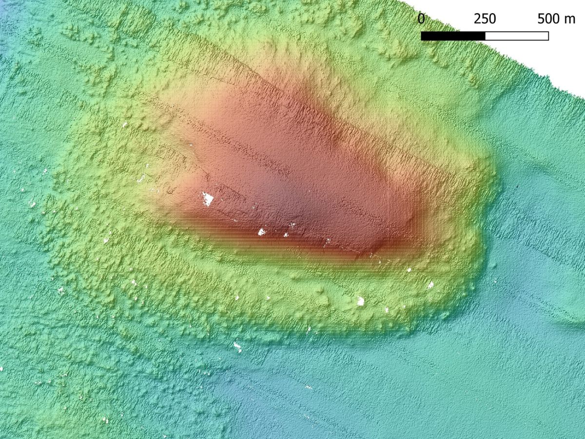
The campaign was also attended by Emanuele Lodolo, a researcher in the Section of Geophysics at OGS and Principal Investigator of the campaign together with Maria Filomena Loreto of CNR-ISMAR. High-resolution reconstructions of the seafloor bathymetry were produced using scientific instrumentation installed onboard the Gaia Blu research vessel. Acoustic waves were also used to investigate the uppermost tens of metres under the seabed, within an area yet to be thoroughly charted.
Gravity coring also facilitated the retrieval of sediment samples that contained evidence of ancient marine deposits. Laboratory analysis, in conjunction with radiocarbon dating of small fossil fragments preserved within the sediments, promises to provide valuable insights into the historical evolution of environments that are now submerged beneath vast layers of seawater.
The resulting reconstructions reveal a complex landscape, reminiscent of contemporary tropical coastal formations. This landscape is characterised by intermittent topographic prominences that extend over a span of tens of kilometres, thereby delineating lagoons and depressions.
The reconstruction of these submerged environments is of considerable importance to archaeology and the study of Mesolithic and Neolithic populations, their migration routes and settlement patterns. For a considerable period, it was widely accepted that Malta had remained largely uninhabited until the Neolithic, approximately 7,500 years ago. However, new evidence suggests the presence of hunter-gatherers on the island as early as around 8,500 years ago. By that time, however, the land bridge connecting Malta and Sicily had already disappeared. Consequently, the new map of the former land bridge cannot be interpreted as a map of the earliest human route to Malta. This raises new questions about how human populations interacted with this landscape during a period of substantial environmental transformation.
Image 1: The geophysical data acquisition laboratory onboard Gaia Blu
Image 2: High-resolution bathymetric image of a section of the ancient land bridge between Sicily and Malta
View also