
SALT.IN - Integration of Geophysical Data for Defining Saltwater Intrusion in the Coastal Areas of Friuli Venezia Giulia
Innovative methodology for the hydro geophysical characterization of coastal and lagoon aquifers
Saltwater intrusion represents one of the main critical issues for coastal aquifers in Friuli Venezia Giulia, with direct impacts on water quality, lagoon ecosystems, and civil and agricultural uses. The SALT.IN project was created to develop and apply an integrated geophysical methodology capable of identifying, mapping, and monitoring the progression of salinization in both groundwater and surface water bodies.
OGS, through its GEO Section, provides advanced expertise in 3D geoelectrics, multicomponent active seismics, and tomographic integration, with the goal of offering the Region reliable scientific tools for the sustainable management of water resources.
Objectives
General Objective
Develop an integrated geophysical approach to define saltwater intrusion in the coastal and lagoon areas of Friuli Venezia Giulia.
Specific Objectives
- Characterize the geometry of coastal aquifers and saline transition zones.
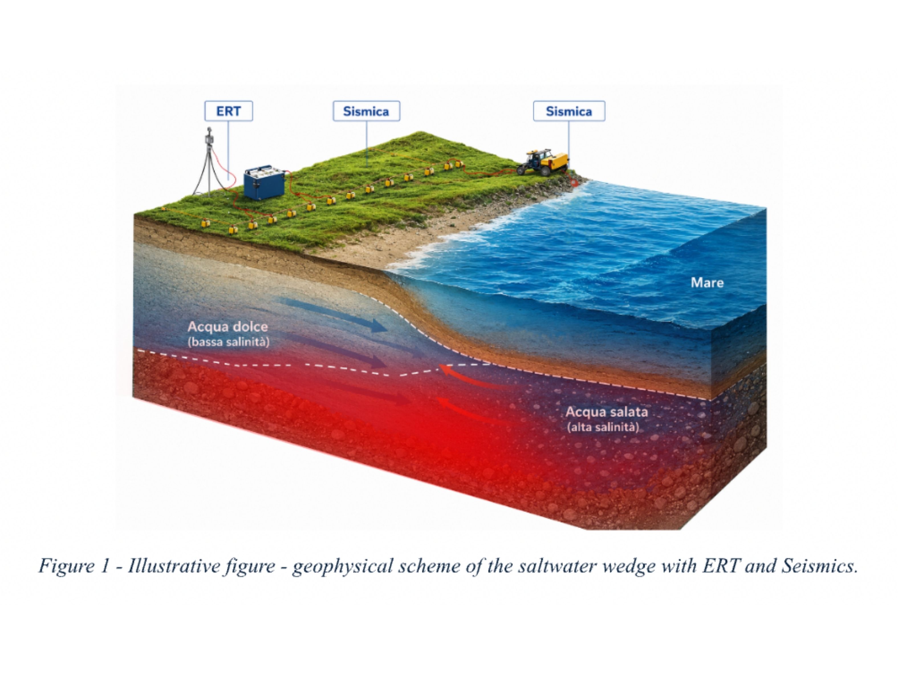
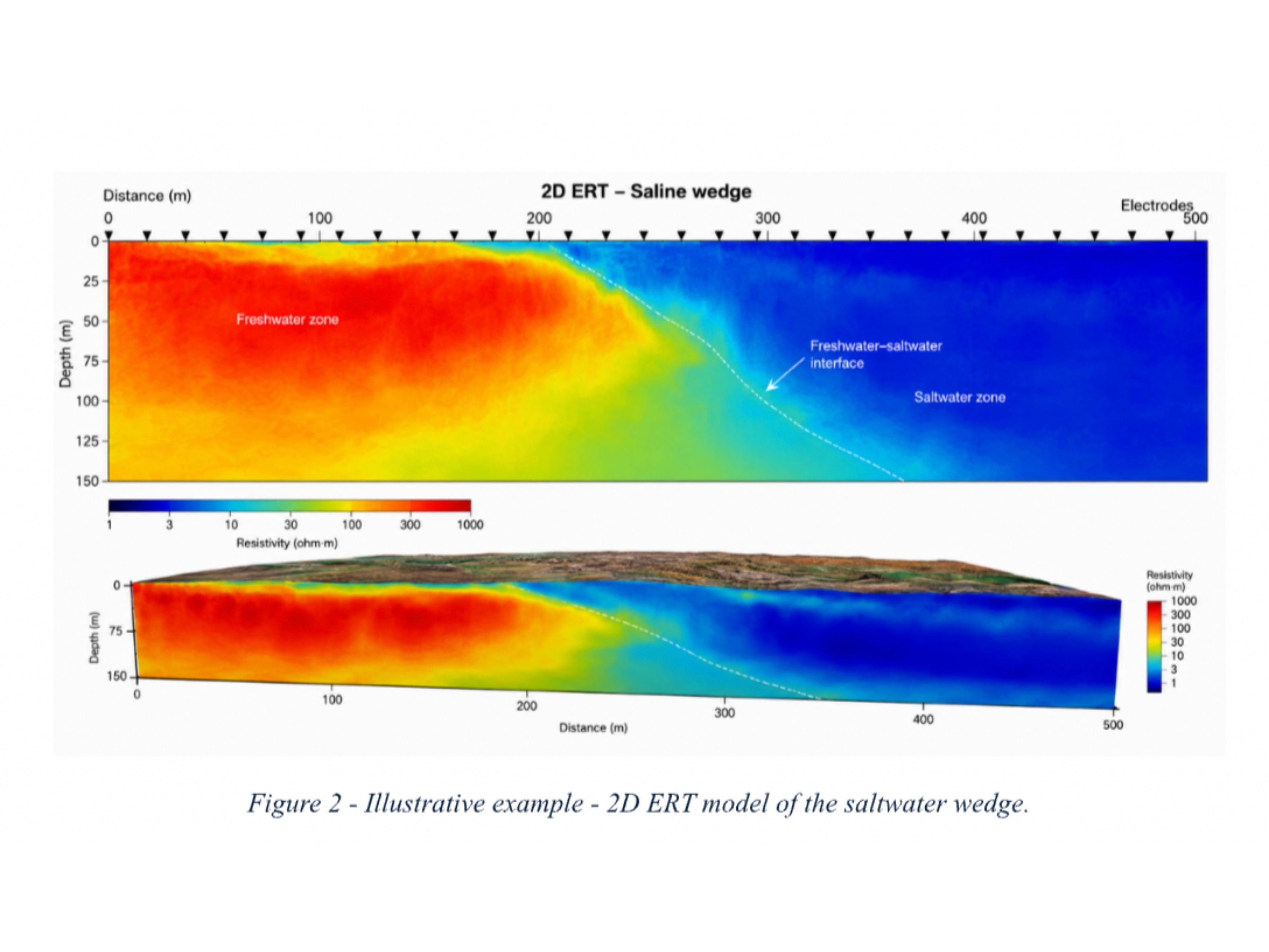
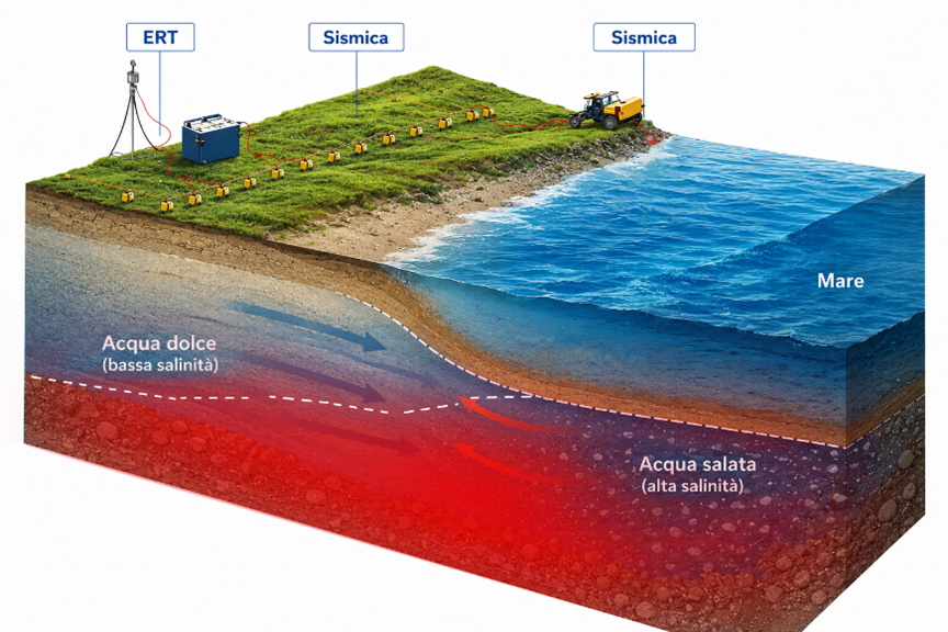
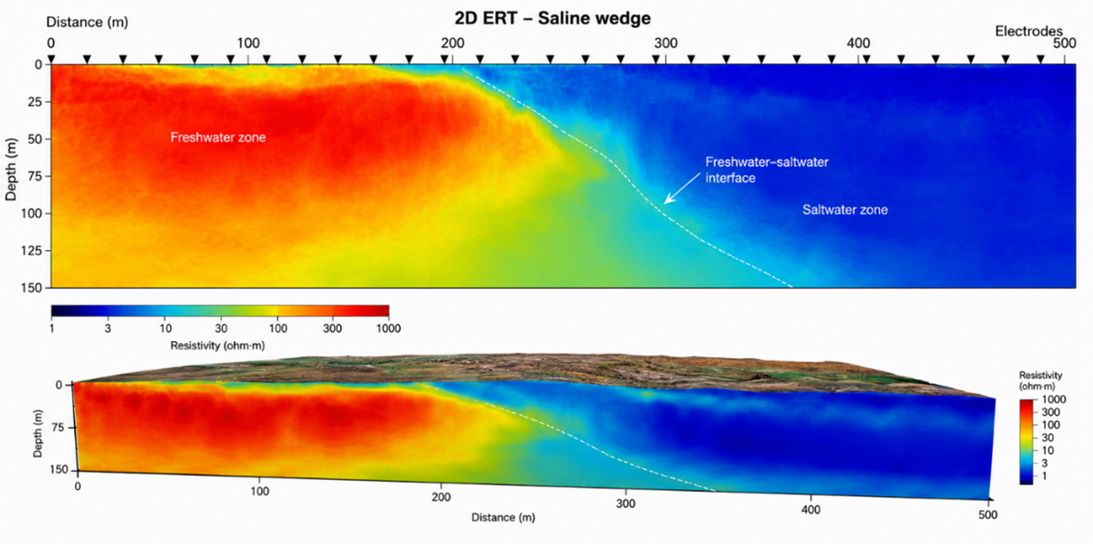
- Identify the depth and extent of the saltwater wedge.
- Integrate geoelectric and seismic data for high‑resolution hydro‑geophysical models.
- Provide technical‑scientific support for regional planning and water‑risk management.
- Consolidate an operational protocol replicable in other coastal contexts.
Methodology
The project includes an integrated campaign of geophysical investigations at sample sites located between:
- Aussa‑Corno system
- Coastal and lagoon area up to the Municipality of Monfalcone
Techniques Employed
- Next‑generation 2D/3D ERT (FullWaver, MPT Multisource)
- Multicomponent active seismics
- Integrated electrical + seismic tomography
- Analysis of existing and bibliographic data
- Hydro‑geophysical subsurface modeling
Investigable Depth
Up to 150 - 200 m, depending on geological and hydrogeological conditions.
Expected Outputs
- 2D/3D models of resistivity and seismic velocities
- Identification of salinized zones and freshwater-saltwater interfaces
- Integrated geophysical maps to support water‑resource management
- Replicable methodological protocol for monitoring the saltwater wedge
- Technical documentation and reports shared with the Region
Info
OGS role
Partner
OGS contact
Program
Autonomous Region of Friuli Venezia Giulia - Central Directorate for Environmental Protection, Energy and Sustainable Development - Water Resources Management Service
Duration
-
Project type
Research
Research and innovation Mission
Earth processes
Disaster risk