
DGPV_AOSTA
Geological investigation project for improving knowledge of slow-evolving deep-seated gravitational slope deformations (DSGSDs)
OGS, through its Geophysics Research Section (GEO), and the Autonomous Region of Aosta Valley will collaborate through the mutual exchange of knowledge on geological investigations aimed at improving understanding of slow-evolving Deep-Seated Gravitational Slope Deformations (DSGSDs).
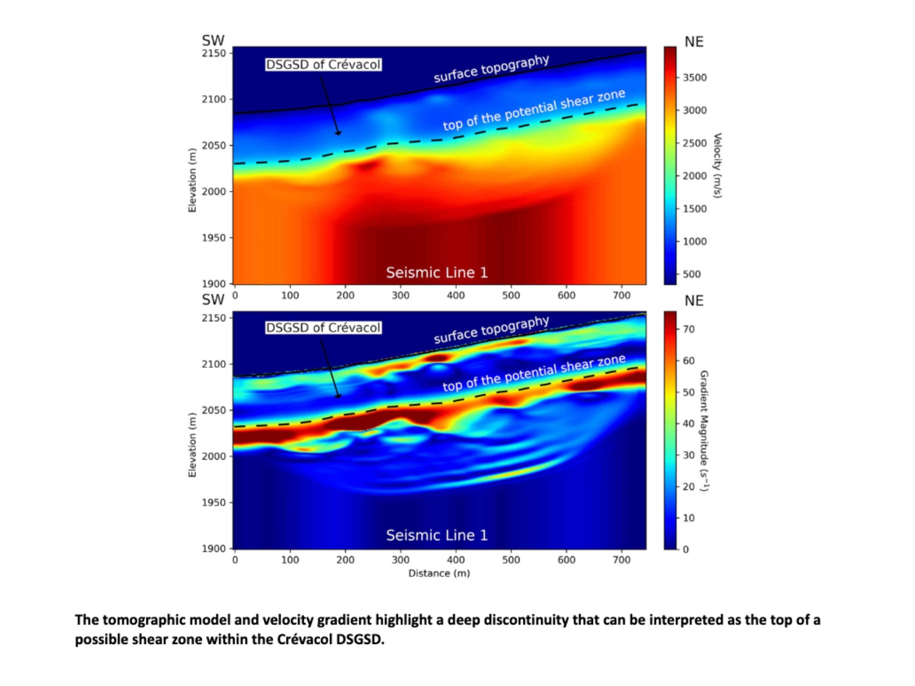
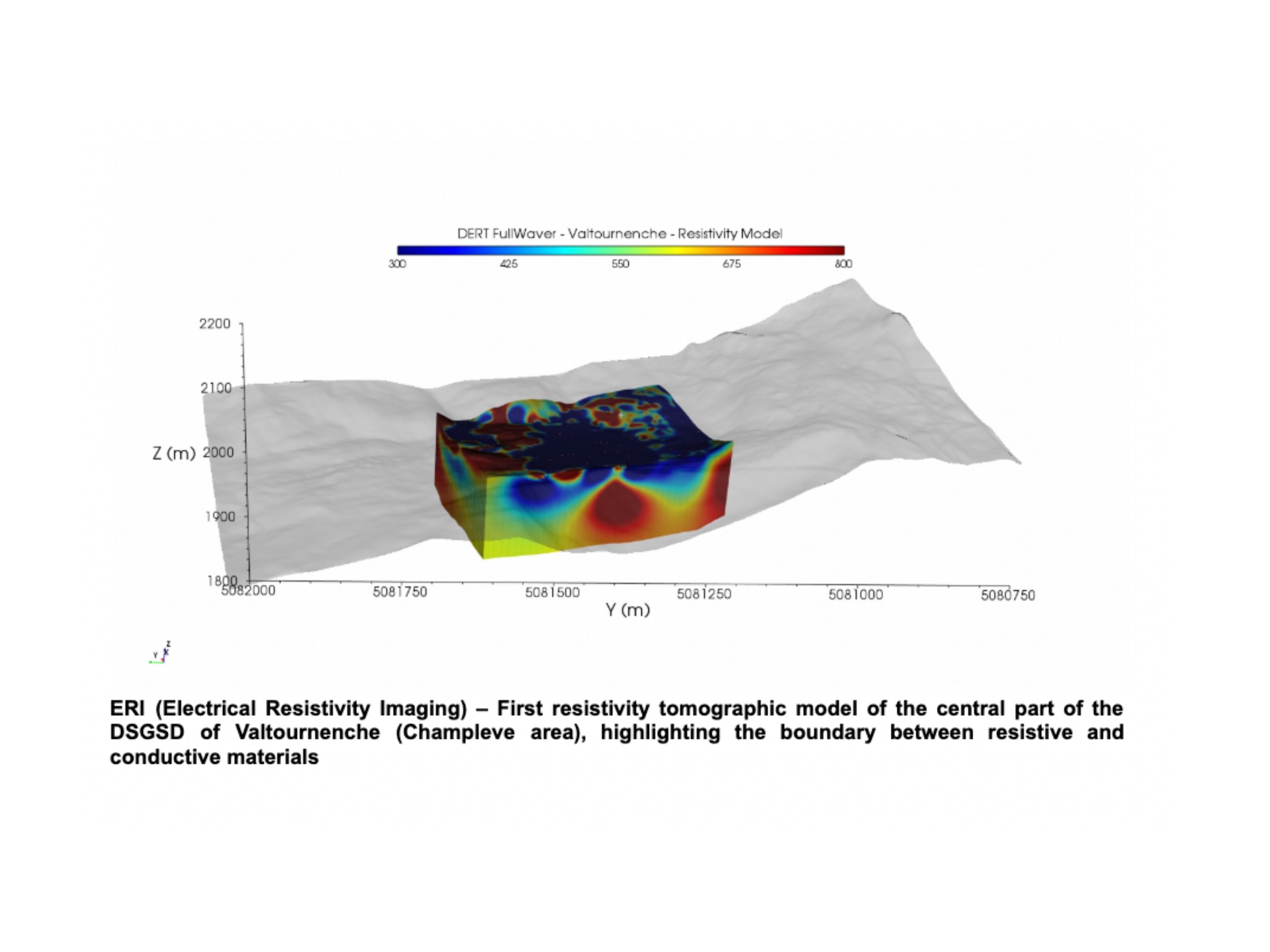
The project concerns the geophysical characterization of two deep-seated gravitational slope deformations in the Aosta Valley, at Saint-Rhémy-en-Bosses and Valtournenche, through an integrated approach based on seismic and geoelectrical investigations. These phenomena involve large volumes of rock and debris affected by slow, deep-seated deformation that cannot be adequately defined through geomorphological observation alone. For this reason, the project aims to reconstruct the internal structure of the slopes, distinguish deformed materials from the stable substratum, and identify the portions that are still active.
The main objective is to improve understanding of the deformational processes affecting Alpine slopes and to build reliable geological and geophysical models that can support risk management and land-use planning. In particular, the investigations are intended to identify possible detachment surfaces, delineate unstable zones, and define the deep architecture of the two DSGSDs, which represent significant case studies because of their structural complexity, glacial inheritance, and hydrogeological conditions.
To achieve these results, OGS employed a coordinated set of advanced techniques, integrating high-resolution seismic surveys with geoelectrical measurements. A particularly important aspect of the project is the use of seismic sources, selected according to slope morphology, accessibility, and the required depth of investigation and resolution: MiniVib was used as a vibrational source, Hydrapulse as an impulsive source for steeper sectors, and the seismic rifle in the most logistically difficult areas. Together with the FullWaver and MPT Multisource geoelectrical systems, this strategy made it possible to investigate the subsurface down to about 150–200 metres and to derive seismic velocity and electrical property models essential for identifying deep structures and supporting technical decision-making in the area.
Info
OGS role
Partner
OGS contact
Program
Agreement between public administrations pursuant to Article 15 of Law No. 241/1990 – Autonomous Region of Aosta Valley
Duration
-
Project type
Servizi
Research and innovation Mission
Earth processes
Disaster risk